
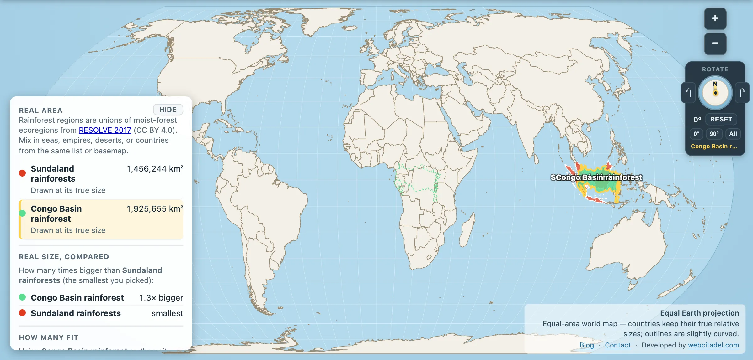
The Amazon is the rainforest people mean when they say rainforest. It is also, in evolutionary terms, comparatively recent — the Andes that make its climate are a young mountain range, and much of the basin’s present character postdates their rise.
The forests of Sundaland — Borneo, Sumatra, Java, the Malay Peninsula — have been doing this for very much longer.
Sundaland rainforests: 1,456,244 km².
Smaller than the Congo Basin’s 1,925,655 km², about a fifth of the Amazon. Old, though. Lowland rainforest has persisted in this region through climate swings that reorganised the vegetation of entire continents, and Borneo’s forests are commonly dated to around 130 million years in continuous form — meaning this forest type was already some 60 million years old when Tyrannosaurus appeared, and it outlived him.
Treat “the world’s oldest rainforest” as a tourist-board claim rather than a settled one: Australia’s Daintree is usually dated older still, and Taman Negara on the Malay Peninsula gets the same billing. What isn’t disputed is the order of magnitude. This is forest measured in hundreds of millions of years.
The continent underneath
Sundaland isn’t just a collection of islands. It is a submerged continent: the Sunda Shelf, a shallow platform that during ice ages, when sea level dropped over 100 metres, was dry land joining Borneo, Sumatra, Java and the Malay Peninsula into one landmass roughly the size of India.
That explains the wildlife. Tigers on Sumatra, elephants on Borneo, rhinos on both — animals that walked there when there was a there to walk to, then got isolated when the sea came back a few thousand years ago. The islands are fragments of a drowned mainland, and the species on them are the survivors of the split.
It also explains one of the sharpest boundaries in biology. Run east from Borneo and you cross the Wallace Line, identified by Alfred Russel Wallace in the 1850s: on one side, Asian fauna — tigers, elephants, monkeys. On the other, a few dozen kilometres away across deep water that never dried out, Australasian fauna — marsupials, cockatoos. Wallace worked out why animals stopped where they did, and in the process co-discovered natural selection, sending Darwin the essay that finally made Darwin publish.
What lives in it
- Orangutans — the only great apes outside Africa, on Borneo and Sumatra, all three species critically endangered.
- Rafflesia arnoldii — the largest single flower on Earth, close to a metre across and up to 11 kg, with no leaves, no stem and no roots. It is a parasite that lives entirely inside a Tetrastigma vine and emerges only to bloom, at which point it smells emphatically of rotting meat, because the flies it needs are not looking for perfume.
- Sumatran rhino, Sumatran tiger, sun bear, proboscis monkey, clouded leopard — and a dipterocarp canopy that mast-fruits at intervals of several years across whole islands at once, in a synchrony nobody has fully explained.
The other half of the sentence
Sundaland is one of the world’s most biodiverse regions and one of its most cleared. Lowland forest — the richest kind, and the easiest to log and convert — has gone across large parts of Sumatra and Borneo, first for timber, then for pulpwood and oil palm. The peat swamp forests are the sharpest edge of it: drained and burnt for planting, they release carbon that has been accumulating in waterlogged ground for thousands of years, which is why Indonesian fire seasons have shown up in global emissions figures and in the air over Singapore and Kuala Lumpur.
A forest that survived 130 million years of climate change has lost a great deal of its lowland extent within a single human lifetime. That is the comparison worth making, and it isn’t an area comparison.
Weigh it against the Congo
Open Sundaland with the Congo Basin dragged onto it. The Congo — a single continuous basin — is noticeably larger. Sundaland’s shape is the giveaway: scattered, island-bound, and drawn around the edges of a shelf that is mostly underwater.
Then measure the whole family: Amazon against Congo, and the mainland Southeast Asian forests immediately to the north.
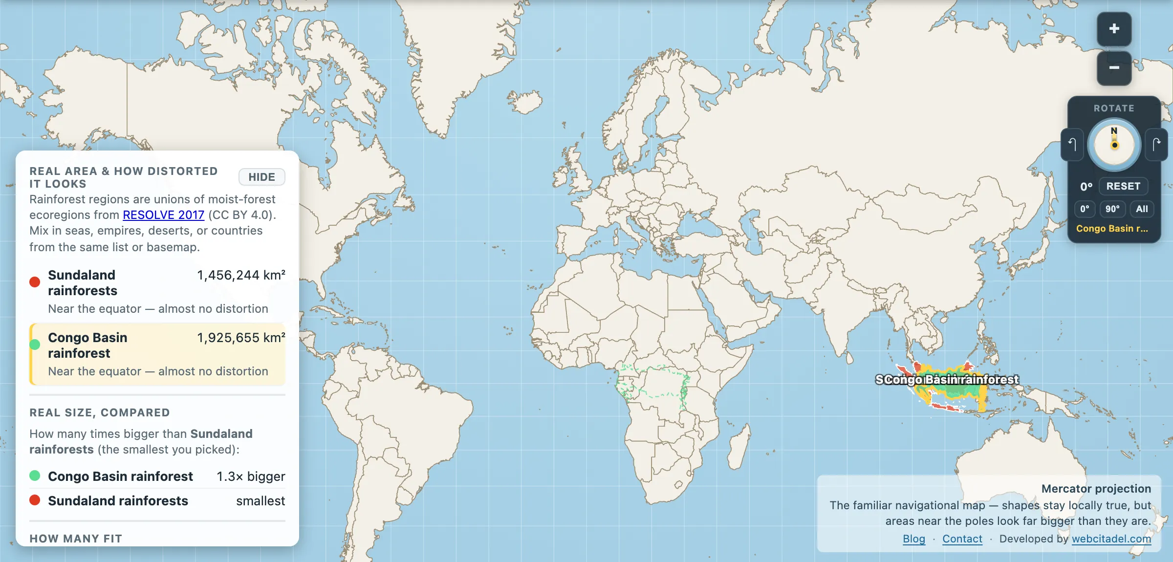
The same shapes on Mercator — the projection almost every map you see uses. Watch what it does to anything far from the equator.
Sources & methodology
- Rainforest regions are unions of moist-forest ecoregions from RESOLVE 2017 (CC BY 4.0), as used in Map Real Size. These are ecoregion boundaries, not current canopy cover; a large share of the area shown has been cleared or converted.
- Forest age figures for Borneo are widely cited but inherently approximate — “continuous rainforest cover in the region” is a claim about vegetation type over geological time, not about individual trees.
- Sunda Shelf exposure, the Wallace Line and species status follow standard biogeographic and IUCN sources.