
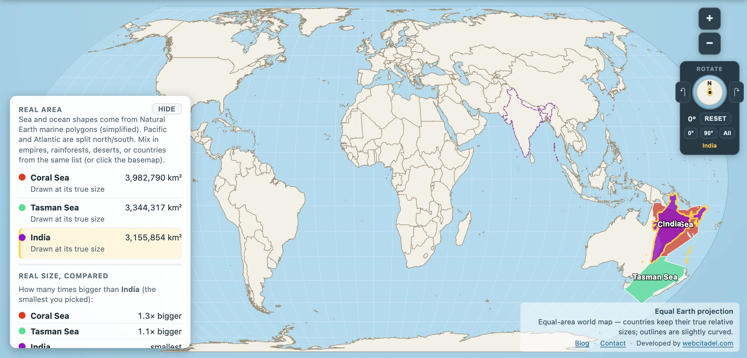
Australians call the Tasman “the Ditch”. You cross the Ditch to get to New Zealand. It’s a three-hour flight, a rugby fixture, a bit of shorthand for a gap that’s more cultural than geographic.
Coral Sea: 3,982,790 km². Tasman Sea: 3,344,317 km². India: 3,155,854 km².
Both of them are bigger than India. The Coral Sea is 1.26 Indias, on its own, and these are the two seas that Australia treats as its front garden and back step.
The Coral Sea: a reef the size of a country
The Coral Sea’s headline feature needs no help from this site, but the number does. The Great Barrier Reef covers roughly 344,400 km² — larger than Italy, larger than the whole of the United Kingdom, and the largest structure on Earth built by living things. It is not one reef but around 2,900 of them plus 900 islands, running 2,300 km down the Queensland coast.
The rest of the Coral Sea is deep water, seamounts and isolated reef systems, much of it inside the Coral Sea Marine Park, one of the largest marine reserves anywhere.
It also holds a specific place in naval history. In May 1942 the Battle of the Coral Sea became the first naval battle in which the opposing fleets never saw each other — everything was done by carrier aircraft over a couple of hundred kilometres of water. Tactically it was close to a draw. Strategically it stopped the Japanese advance on Port Moresby, and the damage done to the carrier force shaped what happened at Midway a month later. A battle fought entirely across a sea that most people couldn’t outline on a map.
The Tasman: the sea that made the crossing hard
The Tasman is named for Abel Tasman, who sailed through it in 1642, charted a piece of Tasmania, sighted New Zealand, and managed to return to Batavia having convinced his employers the voyage was commercially disappointing. It took another century and a quarter before Cook turned up and Europe paid attention.
Its reputation among sailors is worse than its reputation among rugby fans. The Tasman sits in the belt of westerly winds that circle the southern hemisphere unobstructed, and the swell that arrives at New Zealand’s west coast has had thousands of kilometres of open ocean to build up. “Crossing the Ditch” in anything smaller than an airliner is a serious undertaking, and the list of people who have rowed it is short and mostly heroic.
Under it, the geology is stranger still. Much of the Tasman Sea floor is the submerged continental crust of Zealandia — 4.9 million km² of continental block that broke off Gondwana around 80 million years ago and sank, with 94 per cent of it now underwater and only New Zealand, New Caledonia and a scatter of smaller islands breaking the surface.
A 2017 paper led by Nick Mortimer argued it meets all four standard geological criteria for continent status. Which makes New Zealand not a pair of islands but the exposed peaks of a continent, and puts an eighth continent under this sea — missing from your wall map because it is a kilometre beneath it.
Put India in the garden
Open the Coral and Tasman seas with India on an equal-area map. India has been dragged into the Coral Sea, where it fits with water to spare, and the Tasman is sitting right underneath it for comparison.
Then drag India south into the Ditch. It fits there too.
For the sea that beats both of them, see the Philippine Sea at 5.5 million km². And once you’ve stopped thinking of these as gaps between places, the Pacific’s southern half alone is half of all land on Earth.
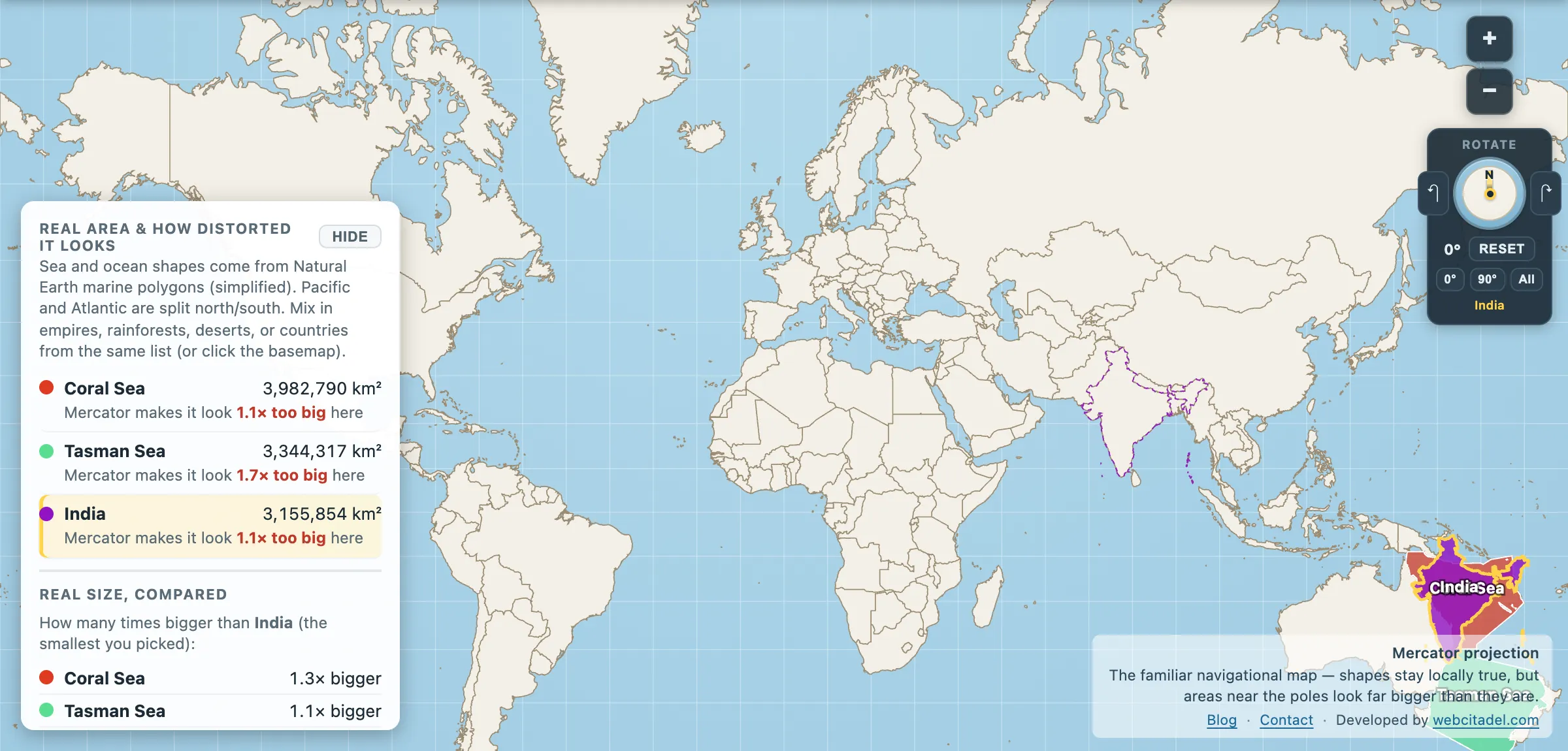
The same shapes on Mercator — the projection almost every map you see uses. Watch what it does to anything far from the equator.
Sources & methodology
- Sea outlines/areas: Natural Earth marine polygons (simplified), as used in Map Real Size. Boundaries between named seas are conventions and different authorities draw them differently.
- India: country area in the app (3,155,854 km²).
- Great Barrier Reef extent, the Coral Sea Marine Park and the Zealandia figures are standard published values; Zealandia’s classification as a continent is a geological argument, not an administrative fact.