
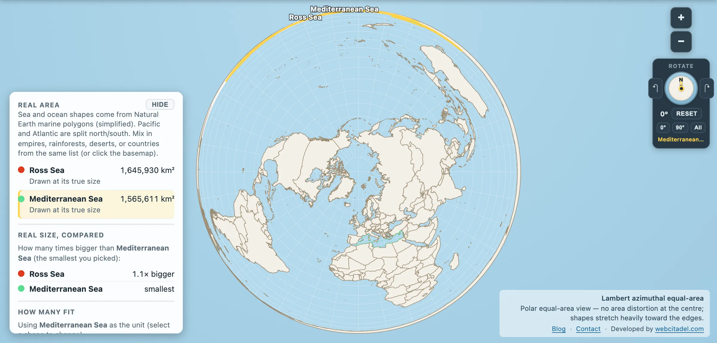
The Mediterranean is the most consequential body of water in Western history. Phoenicians, Greeks, Carthage, Rome, Venice, the Ottomans, Nelson, Suez. It has a literature.
The Ross Sea has penguins and a dent at the bottom of a map most people never look at. It is also bigger.
Ross Sea: 1,645,930 km². Mediterranean Sea: 1,565,611 km².
Larger by about 80,000 km², which is roughly an Austria of extra water.
A Spain of floating ice
The Ross Sea’s southern half isn’t open water. It’s the Ross Ice Shelf, the largest ice shelf on Earth at roughly half a million km² — near enough the size of Spain — floating on the sea while remaining attached to the continent, with a seaward cliff running for hundreds of kilometres and standing tens of metres above the water.
Early expeditions called it the Great Ice Barrier, which is exactly what it was to them: you sail south until a wall of ice several storeys high tells you the sailing is over. James Clark Ross found it in 1841 and reportedly observed that you might as well try to sail through the cliffs of Dover.
That barrier is why the Ross Sea is the gateway to the South Pole. It let expeditions get further south by ship than anywhere else on the continent, then start walking from a surface that was already most of the way there. Amundsen based himself at Framheim in the Bay of Whales and reached the Pole in December 1911. Scott worked from McMurdo Sound on the other side of the sea and reached it a month later, and did not come back. Both routes exist because this particular sea cuts several hundred kilometres deeper into Antarctica than the coast does elsewhere.
The engine room of the world ocean
The Ross Sea also does something to the planet’s plumbing that matters a very long way from Antarctica.
When sea water freezes, the salt is left behind. In the polynyas — patches of open water within the ice — that brine makes the surrounding water dense enough to sink, forming Antarctic Bottom Water that slides down the continental slope and spreads north along the sea floor into the Atlantic, Pacific and Indian basins. It is one of the main sources of the coldest, densest water in the world ocean, and one of the drivers of the global overturning circulation.
Most of the deep ocean, anywhere on Earth, was at the surface here or somewhere like it. Some of it centuries ago.
In 2016 CCAMLR agreed a marine protected area covering 2.09 million km² of the Ross Sea region, in force from 1 December 2017 — the largest marine protected area in the world when it was created, with 1.12 million km² of it closed to all commercial fishing. It needed the unanimous agreement of all twenty-five CCAMLR members, which makes it a rare piece of successful international negotiation over a place nobody owns.
See it from above the pole
Open the Ross Sea with the Mediterranean on a polar equal-area projection — the only kind of map on which the bottom of the world isn’t a smear. The Mediterranean has been dragged down from Europe and dropped into Antarctica’s southern bay, where it fits with room around it.
Mercator cannot show you this. At those latitudes it stops being a map and starts being a stretching exercise — the same problem that makes Antarctica itself unreadable.
And once you’ve seen the Mediterranean out-measured, note that it had already humbled France at two and a half times over. Scale is a chain, and everyone’s a link.
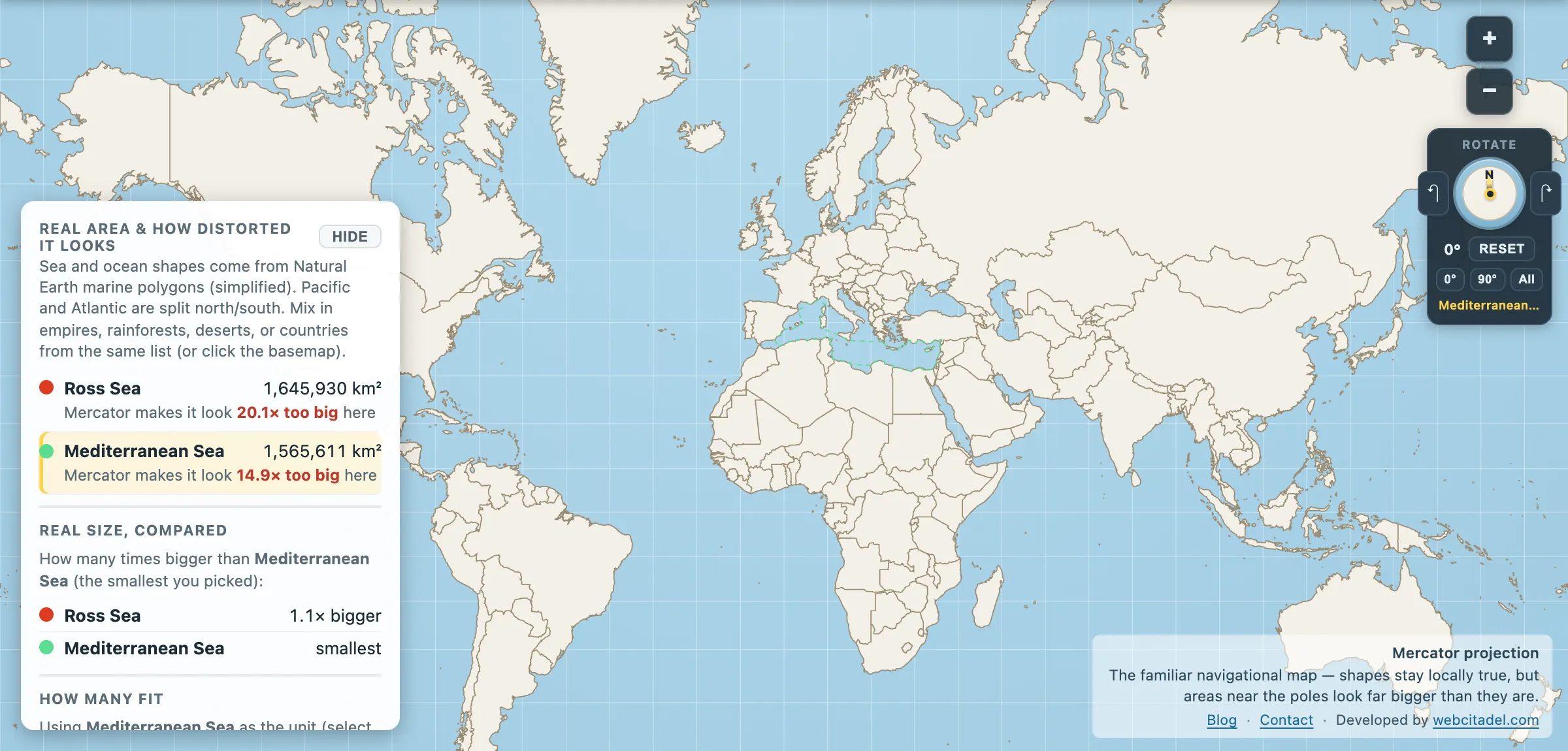
The same shapes on Mercator — the projection almost every map you see uses. Watch what it does to anything far from the equator.
Sources & methodology
- Sea outlines/areas: Natural Earth marine polygons (simplified), as used in Map Real Size. The Ross Sea’s northern boundary is a convention rather than a coastline, and different authorities place it differently.
- Ice shelf area, bottom water formation and the CCAMLR MPA figures follow CCAMLR and NSIDC published values; the ice shelf’s extent changes as it calves and regrows, and quoted areas range from roughly 473,000 to 500,000 km².