
If you were at school before about 2000, you learnt four oceans. If you were at school after, it depended on which country and which textbook. On 8 June 2021 — World Oceans Day — National Geographic began labelling a fifth, and the argument became mainstream.
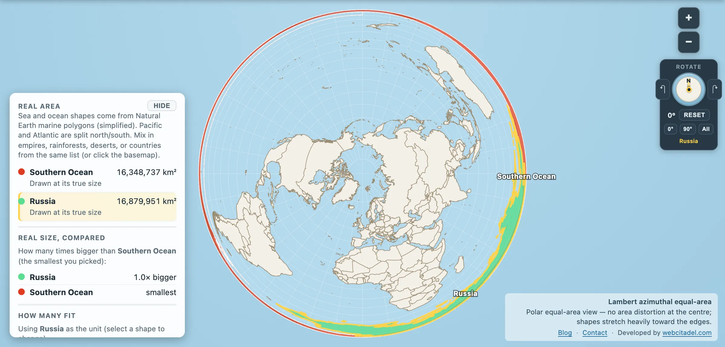
Southern Ocean: 16,348,737 km². Russia: 16,879,951 km².
The newest ocean on the map is 97 per cent of the largest country on Earth. It has been there the whole time.
An ocean with no far shore
Every other ocean is defined by the land around it. The Atlantic is the water between the Americas and Europe-Africa. The Indian Ocean is bounded by Africa, Asia and Australia. Coastlines do the defining.
The Southern Ocean can’t work that way, because at those latitudes there is a continuous ring of water all the way round the planet with nothing to stop it. So it is defined by what the water does instead: the Antarctic Circumpolar Current, the only current that circles the globe unobstructed, running west to east around Antarctica and separating cold polar water from the warmer water to the north. The conventional northern limit is drawn at 60° south.
That is a genuinely different kind of definition, and it’s the reason the naming argument lasted so long. The International Hydrographic Organization proposed the Southern Ocean formally in 2000; the proposal was never ratified, partly over where the boundary should sit — Australia, among others, has traditionally used a line further north. The result is a body of water whose existence is agreed on by oceanographers and disputed by committees.
The strongest current on the planet
The canonical figure for the ACC has long been around 137 million cubic metres of water per second through Drake Passage. A four-year campaign of moored instruments published in 2016 revised that sharply upward, to about 173 million cubic metres per second — roughly 30 per cent more than the number that had been feeding climate models for decades.
For scale, that is well over a hundred times the combined flow of every river on Earth. It is the largest current in the world by volume transported, and it is the mechanism that keeps Antarctica cold — a moat of circulating water isolating the continent from warmer subtropical seas.
It hasn’t always existed. The ACC could only start once the gaps opened: Drake Passage between South America and the Antarctic Peninsula, and the Tasmanian gateway between Australia and Antarctica, both products of continental drift roughly 30 to 35 million years ago. The current started, the moat closed, and Antarctica froze. The Southern Ocean didn’t form around a frozen continent — it is a fair part of why the continent froze.
It also does a disproportionate share of the planet’s heavy lifting on heat and carbon uptake, absorbing a large fraction of the excess heat and a significant share of the human-emitted carbon dioxide taken up by the world ocean. This is the sea that has been quietly limiting how bad things are.
For the water it exports, see the Ross Sea, one of the places where the densest water in the world ocean is manufactured.
Look at it from underneath
Open the Southern Ocean with Russia on a polar equal-area map. Russia has been dragged down from Eurasia and laid on the ring of water at the bottom of the world, where it very nearly covers it.
This is a view Mercator physically cannot give you — near the poles it stretches everything past the point of meaning, which is why the Arctic Ocean needs the same treatment at the other end. Spin the globe view and the Southern Ocean stops being the strip along the bottom edge of the classroom map and becomes what it is: a ring around the planet.
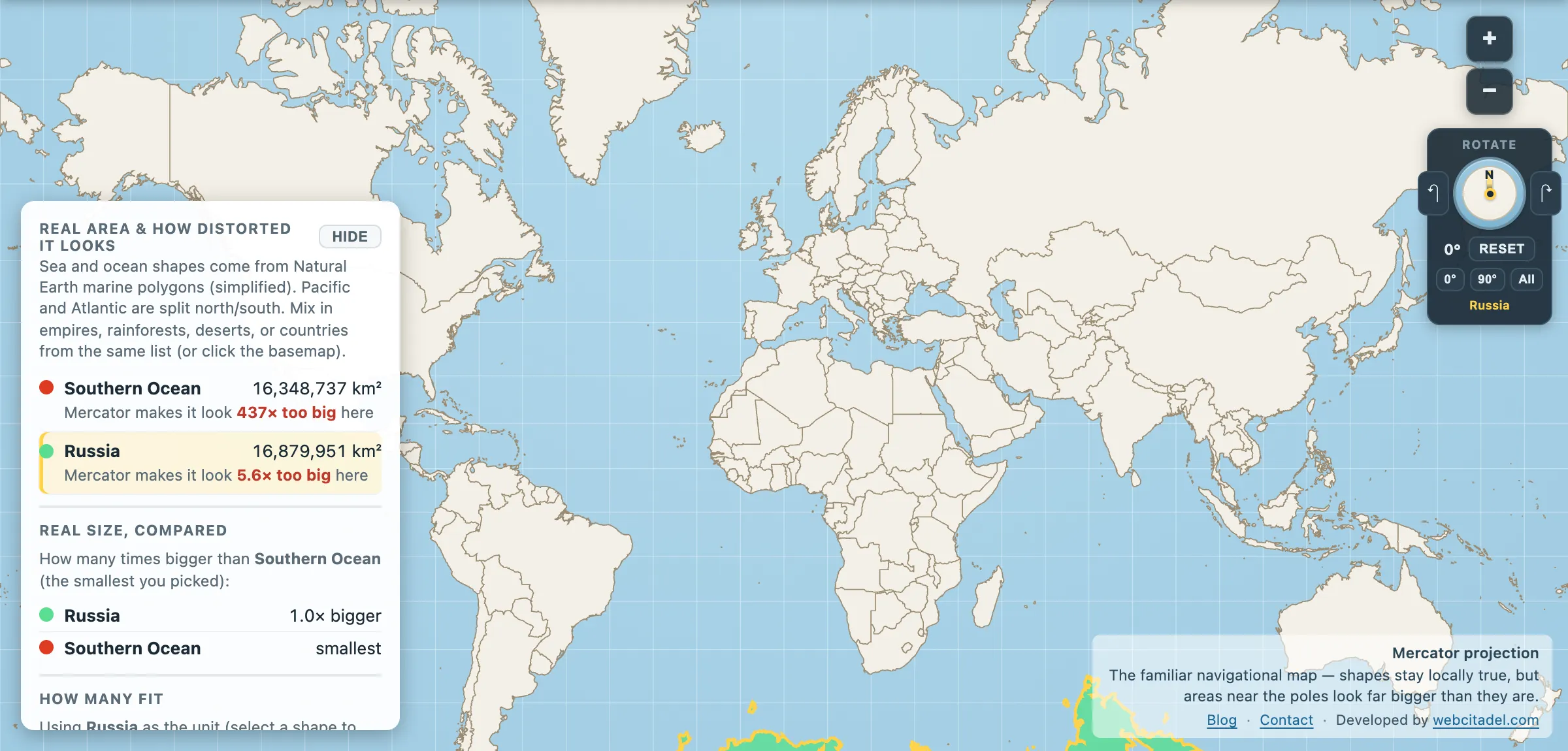
The same shapes on Mercator — the projection almost every map you see uses. Watch what it does to anything far from the equator.
Sources & methodology
- Ocean outlines/areas: Natural Earth marine polygons (simplified), as used in Map Real Size. The Southern Ocean’s northern limit is a convention; the commonly quoted figure of roughly 20 million km² uses a different boundary from the polygon here.
- Russia: country area in the app (16,879,951 km²).
- ACC transport figures follow Donohue et al. (2016), whose Drake Passage moored array gave 173.3 Sv against the long-standing canonical value near 137 Sv; estimates vary by measurement method and location. The 2000 IHO proposal and the 2021 National Geographic decision are as published.