
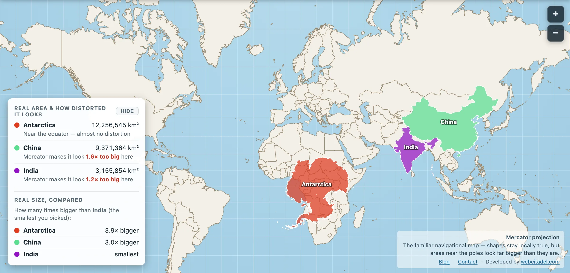
On most world maps Antarctica is a white ribbon along the bottom, a margin decoration, the bit the poster manufacturer remembered at the last minute. Your brain files it under “cold, flat, ignore”.
The measurements disagree.
Antarctica: 12,256,545 km².
That is bigger than China and India combined (9.37M + 3.16M). Bigger than Europe. About 70 per cent of Russia. Nearly nine Greenlands of ice, rock and research stations, holding roughly 70 per cent of the planet’s fresh water in frozen form.
The projection’s favourite vanishing act
Mercator can’t actually show the poles. The projection runs off toward infinity before it gets there, so Antarctica gets cropped, smeared along the bottom edge or quietly omitted from classroom maps that “go to 80 degrees”. When it does appear, the stretch is grotesque and somehow still fails to communicate mass. You remember a strip. You do not remember a continent.
Equal-area maps and globes fix the comedy. Antarctica becomes a proper lobe of the planet again, which is what it has been the whole time.
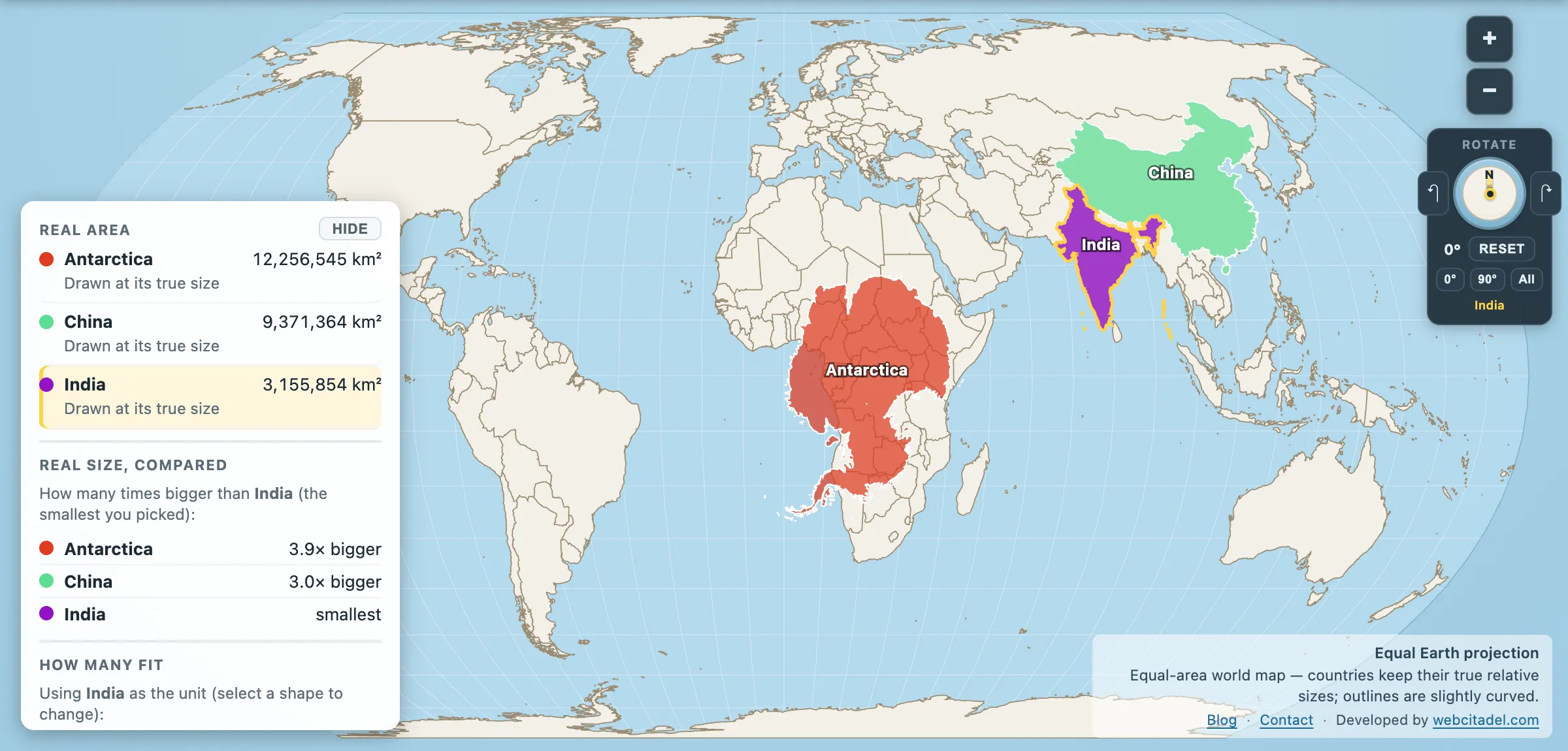
The same shapes on Equal Earth, where every square kilometre is drawn the same size wherever it sits. This is the honest version.
Drag the bottom of the world to the middle
Open this scene. Antarctica has been hauled up to the equator and parked next to China and India. The “ribbon” turns into a continent that swallows both Asian giants and keeps going.
Then flip to the globe view and spin south. No costume, no crop, no footnote. Just the fifth largest continent, pretending for decades that it was trim.
If Greenland was framed, Antarctica was edited out of the movie and still billed as a location.