
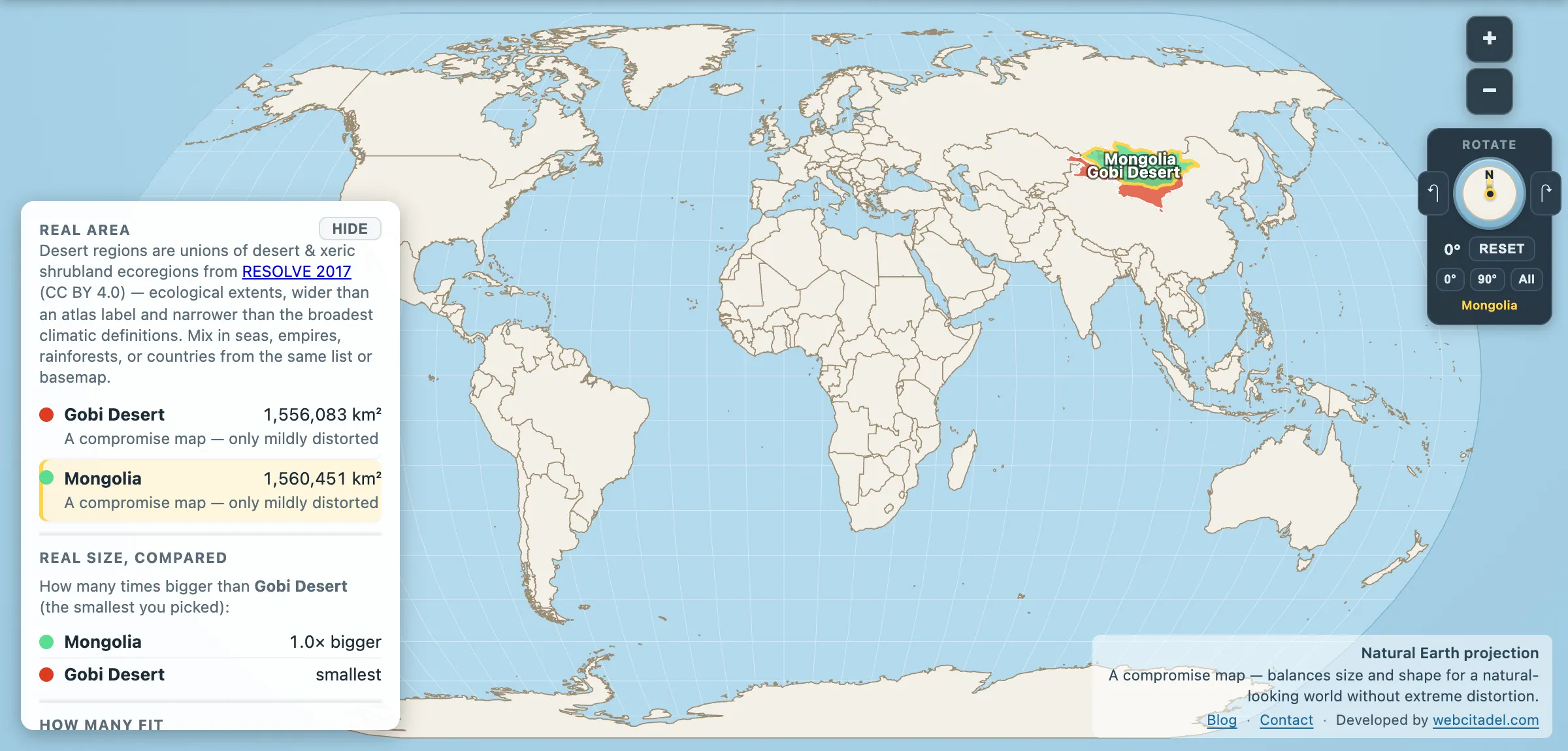
Picture a desert. Most people invent sand, heat and something vaguely Saharan. Picture the Gobi and the mind often returns a blank — or a vague wave at “somewhere above China.” That blank is doing more work than the dunes.
In Map Real Size’s deserts catalog:
Gobi Desert: 1,556,083 km². Mongolia: 1,560,451 km².
A gap of 4,368 km² — under a third of one per cent. The Gobi is, to within a rounding error, the size of the country it mostly lies in. It is also about 2.5× France. Two and a half Western European countries of rock, gravel and winter wind, stretched across southern Mongolia and northern China. It is not scenery. It is landmass — and the coincidence with Mongolia’s own borders is exactly that, a coincidence, since roughly a third of the desert lies south of them in China.
Cold enough for frost on the sand
The Gobi is a cold desert, which sounds like a contradiction until you stand in one. Summers can push past 40 °C. Winters drop below −40 °C. Daily swings of tens of degrees are normal. Rainfall in much of the basin is a few inches a year; snow and frost settle on dunes that Hollywood would rather leave blank. Only a small share of the surface is classic golden sand — most of it is bare rock, pavement and scrub.
It sits in the Himalayan rain shadow. Moisture riding up from the Indian Ocean never quite makes the crossing. Geography wrote the drought; the Gobi kept the lease.
Fossils, camels, and a bear that should not exist
The desert’s CV has always been stranger than its reputation:
- In 1923, at Bayanzag — the Flaming Cliffs — Roy Chapman Andrews’s American Museum expedition found the first scientifically confirmed dinosaur eggs, nests that rewired how paleontology thought about reptile reproduction. The red sandstone is still yielding Cretaceous specimens a century later. Andrews’s fedora-and-caravan image later fed the Indiana Jones myth; the eggs were real.
- Wildlife reads like a rarity auction: wild Bactrian camels (two humps, critically scarce), khulan (Asiatic wild ass), gazelles, and the Gobi bear (mazaalai), often called the only bear adapted to true desert — with a surviving population counted in the low dozens.
- Paleolithic and Neolithic sites sit under the same sky. People have been navigating this “empty” place for tens of thousands of years.
Compare the fame gap with the Sahara next to the United States. One desert got the movie deal. The other got the fossils and the frost.
Put a country on the gravel
Open Gobi vs Mongolia on Natural Earth, a compromise projection that keeps the world looking familiar without Mercator’s polar theatre. The two shapes sit almost on top of each other. Then drag France in and watch it disappear into the gravel two and a half times over.
The gap, spelled out, is on the Gobi vs Mongolia.
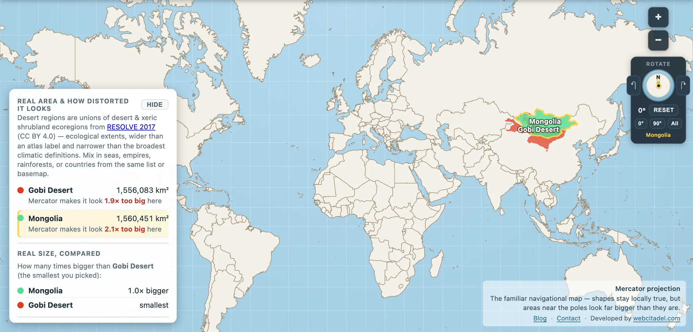
The same shapes on Mercator — the projection almost every map you see uses. Watch what it does to anything far from the equator.
Sources & methodology
- Gobi outline/area: union of Desert & Xeric Shrubland ecoregions from RESOLVE Ecoregions 2017 (CC BY 4.0), as used in Map Real Size — the Eastern Gobi steppe, Alashan Plateau, Junggar Basin, Gobi Lakes Valley and Great Lakes Basin regions unioned. Narrower definitions of the Gobi run near 1.0–1.3 million km²; desert edges are argumentative by nature.
- Mongolia, France: country areas in the app (1,560,451 and 635,073 km²).
- Wildlife and paleontology notes draw on widely reported field and museum accounts (AMNH Flaming Cliffs work; IUCN-listed desert fauna). Populations of rare species move year to year.