
Ask someone what they know about the Sahara and you get “desert” and maybe “camels”. Ask them how big it is and you get a hand wave over the top of Africa, as if the empty bit were a margin note.
The Sahara covers between 7.2 and 9.2 million km², depending on where you stop counting — and both ends of that range are country-scale.
- On the climatic definition, the one encyclopaedias use: about 9.2 million km². The United States is 9,439,564. Same weight class.
- On the ecoregion boundaries this app draws: 7,216,796 km². That is 94 per cent of Australia.
So the Sahara is either a United States or an Australia. There is no reading of it that is not continental. One of the two is a country with fifty states and a seat at the G7; the other is weather and sand.
The desert that outranks countries
The Sahara stretches across Algeria, Libya, Egypt, Mali, Niger, Chad, Mauritania, Sudan and more, from the Atlantic to the Red Sea. Algeria alone is 2.3 million km². Libya 1.6. Put a few of those together and you’re already past India.
It is not empty in the ways the stereotype needs. People have lived in and around it for millennia. It grows and shrinks with climate. The “green Sahara” of the early Holocene had lakes and savannah where the dunes are now. The desert is a phase, not a void. A very large phase.
Why Africa keeps getting smaller in your head
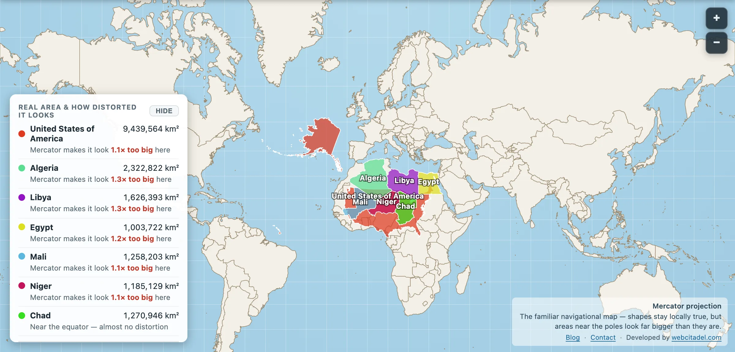
Mercator draws equatorial Africa honestly and inflates the north. The Sahara sits low enough to miss the full polar costume, so the biggest desert on Earth reads as “the beige part” while Greenland cosplays a continent. Combined with the habit of drawing Africa as one political blank, the desert never gets a size. It gets a texture.
Drop America on it
Open this scene. The USA is already parked across North Africa with the Sahara’s big countries lit around it. The fit is uncomfortable in the useful way. A superpower silhouette, desert underneath, neither obviously winning.
Then remember the rest of the continent is still there. The Sahara is the dry foyer. Africa itself is three of these. The empty bit at the top was never empty, and it was never bit-sized.
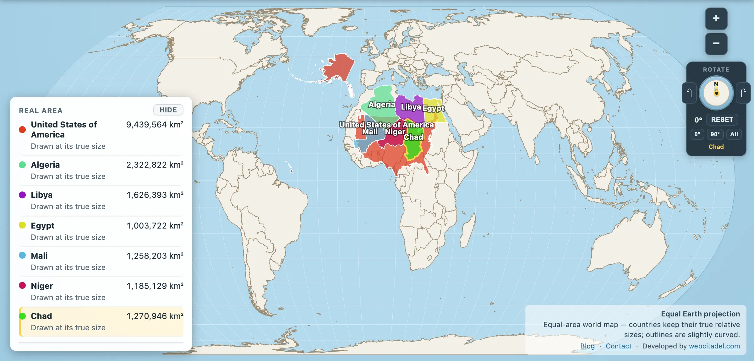
The same shapes on Equal Earth, where every square kilometre is drawn the same size wherever it sits. This is the honest version.
Why the Sahara has two different sizes
Both figures at the top of this post are honest, and the gap between them is the whole problem with measuring deserts.
9.2 million km² is the climatic Sahara: everywhere north Africa is arid enough to qualify, from the Atlantic to the Red Sea. It is the figure encyclopaedias use, and the one most people mean.
7,216,796 km² is the union of the eight Saharan ecoregions — boundaries drawn by ecologists around the arid biome itself. It runs tighter than the climatic definition at the margins, where the desert grades into Sahel and Mediterranean scrub without anywhere obvious to put a line.
Deserts have no coastlines. Every desert area you have ever read is somebody’s decision about where to stop counting, and the two figures here are two different decisions rather than one of them being wrong. The same fault line runs through Australia’s deserts, where the same two conventions differ by a factor of four.
For that reason this post’s scene uses the outlines of the Saharan countries — Algeria, Libya, Egypt, Mali, Niger, Chad — rather than the desert polygon. Those borders are surveyed. The desert’s are argued about.