
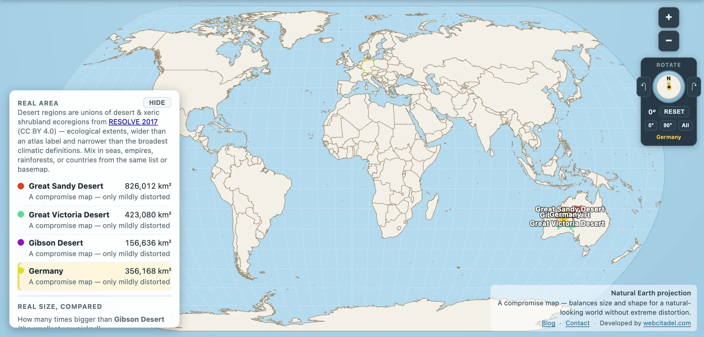
Ask how big Australia’s three great deserts are — the Great Sandy, the Great Victoria, the Gibson — and you can get two answers, from two entirely respectable sources, four times apart.
Atlas label polygons, the shapes a cartographer draws to letter a name across a region:
- Great Sandy 160,538 km² · Gibson 104,829 km² · Great Victoria 72,215 km²
- Total: about 337,600 km² — less than Germany
Ecoregion boundaries, drawn by ecologists around where the arid biome actually is:
- Great Sandy-Tanami 826,012 km² · Great Victoria 423,080 km² · Gibson 156,636 km²
- Total: 1,405,728 km² — about four Germanys
Same three deserts. A gap of over a million square kilometres. Neither source is lying.
Why the gap is that big
A label polygon answers “where do I print the words Great Victoria Desert so the reader knows roughly where it is?” It is a piece of typography. It deliberately stops short of the edges, because a label sprawling to the true boundary would collide with everything around it.
An ecoregion answers “where does this ecosystem begin and end?” — drawn from vegetation, rainfall and soil, with no obligation to look tidy.
Australian sources using the Köppen arid classification land in between: the Great Victoria at around 348,750 km², the Great Sandy at around 284,993, the Gibson at around 156,000. Three methods, three answers, all defensible.
Map Real Size uses the ecoregion figures, because they are measurements rather than typography, and because the rainforests in this app are built the same way from the same source. But the honest headline is the disagreement, not any one of the numbers. Deserts do not have coastlines. Every desert area you have ever read is somebody’s decision about where to stop counting — the same fault line that gives the Sahara two different sizes.
The thing that actually is enormous
Here’s what doesn’t move under any definition: around 70 per cent of the Australian mainland is arid or semi-arid. Not the named deserts — the whole middle. Something like 5.4 million km² of country dry enough to make farming a negotiation, on a landmass nearly the size of the contiguous United States.
Even at 1.4 million km², the three headline deserts are about 18 per cent of the continent — barely a quarter of the dry country. The rest isn’t called desert. It’s mulga, spinifex, saltbush, gibber plain, salt lake — arid land that never got a name grand enough to print in bold.
That’s the trick the map plays here, and it’s the mirror image of Mercator’s. The Mercator projection makes small things look big. Naming makes big things look small: give a region a name and a boundary and the eye stops there, as if the dryness politely ended where the label does.
Two more things the myth gets wrong. Australia’s deserts are not empty — they hold Aboriginal communities whose continuous presence in this country runs back tens of thousands of years, and some of the earliest evidence of human occupation anywhere outside Africa. And the sand is not the standard picture: much of it is red dune country with spinifex grass across the top, which from the air reads as a textured pink-orange plain rather than the bare Saharan sculpture people expect.
Measure it yourself
Open Australia’s three deserts with Germany dropped into the middle of them. Germany disappears into the Great Sandy alone with room to spare, and you would need four of it to cover all three.
Then remember that even this is only about a quarter of Australia’s dry country. The desert on the label is the small part of the dry.
For the opposite lesson, drag the continent itself up to European latitudes and watch the wall map’s version of Australia fall apart.
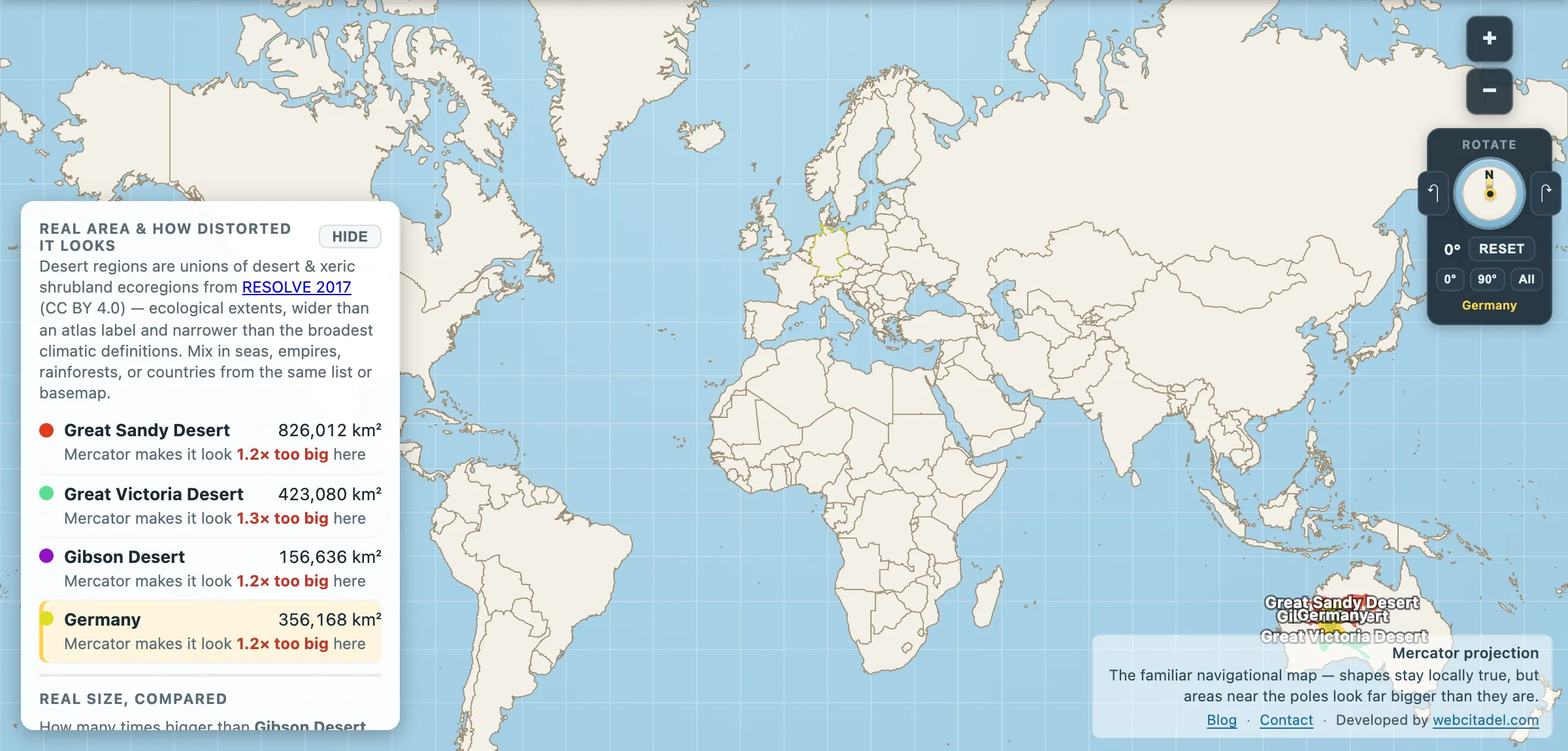
The same shapes on Mercator — the projection almost every map you see uses. Watch what it does to anything far from the equator.
Sources & methodology
- Desert outlines/areas: union of Desert & Xeric Shrubland ecoregions from RESOLVE Ecoregions 2017 (CC BY 4.0), as used in Map Real Size. RESOLVE merges the Great Sandy and Tanami into one ecoregion, so the Great Sandy figure here includes the Tanami. The label-polygon figures are Natural Earth physical regions; the middle set are the widely published Australian arid-zone classifications.
- Germany, Australia: country areas in the app (356,168 km² and 7,706,123 km²).
- The 70 per cent arid/semi-arid share is the standard figure used by Australian government and scientific bodies; the exact number varies with the aridity index chosen.