
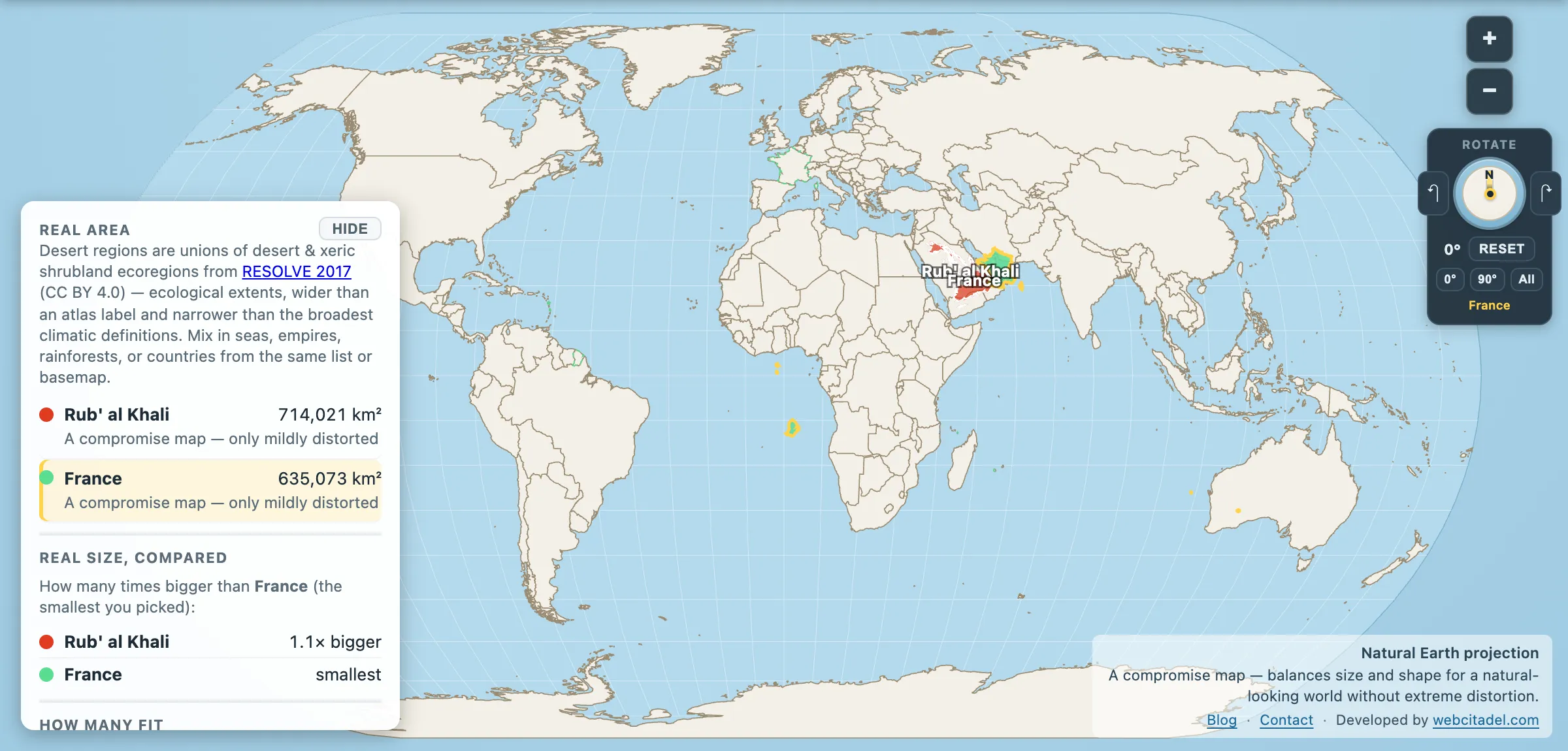
Most deserts are a mosaic. Rock here, gravel there, a wadi, a range of hills, a stretch of dunes for the postcard. The Rub’ al Khali is not a mosaic. It is the same thing, over and over, for as far as it goes — the largest continuous sand desert on Earth.
Rub’ al Khali: 714,021 km². France: 635,073 km².
A France and an eighth, made of nothing but sand arranged by wind.
The scale of the sand
The Empty Quarter fills the southern third of the Arabian Peninsula, spilling across Saudi Arabia, Oman, the UAE and Yemen. Its dunes run to 250 metres in places — taller than the Shard, made of loose sand, moving. Some of them are arranged in ridges that run unbroken for hundreds of kilometres, which is the sort of feature you only really see from orbit and only really believe when you try to drive across one.
Rainfall is under 35 mm a year in most of it, and in some years it is zero. Summer temperatures pass 50 °C. There are no permanent rivers, no permanent settlements in the interior, and no road across the middle.
It has not always been like this. Scattered through the sand are the beds of ancient lakes that held water during wetter phases in the last few hundred thousand years, with fossil hippo and freshwater shell to prove it. The Empty Quarter is not primordially empty. It is a place that dried out, and archaeologists have been finding the stone tools of the people who were there before it did.
Ubar, Thomas, and Thesiger
The desert’s grip on the European imagination comes from being the last big blank left. Bertram Thomas made the first recorded crossing by an outsider in 1930–31; Harry St John Philby followed within months. Wilfred Thesiger crossed it twice in the late 1940s with Bedu companions, and the book he wrote about it, Arabian Sands, is essentially an elegy — he could see the oil economy arriving behind him and knew what it meant for the life he’d been travelling through.
He was right. Under the sand sits some of the most valuable real estate on the planet: Shaybah, on the Saudi–UAE frontier, is a major field operating in the middle of dunes that had to be flattened to build the airstrip.
Somewhere out there is also supposed to be Ubar, the caravan city that the Quran and local tradition say was swallowed by the sand. In the early 1990s a team using space-radar imagery to trace old caravan tracks excavated a site at Shisr in Oman, announced it as the lost city, and got a wave of headlines calling it the Atlantis of the Sands. Archaeologists have argued about that identification ever since. What’s not in doubt is that the tracks were real: trade routes for frankincense, crossing ground nobody would cross for anything less.
Lose a country in the sand
Open the Empty Quarter vs France. France has been dragged from Europe onto the Arabian Peninsula and it disappears into the sand with room around every edge.
Then do the reverse in your head. Every city in France, every road, every vineyard, every one of its sixty-eight million people — that footprint, and what’s on this one is dunes.
Compare it with the Gobi, which is the size of Mongolia, which is bigger overall but mostly rock and gravel rather than sand. Nowhere else on the planet holds this much sand in one continuous piece.
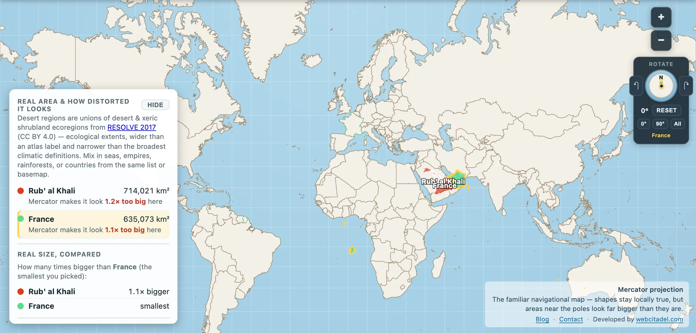
The same shapes on Mercator — the projection almost every map you see uses. Watch what it does to anything far from the equator.
Sources & methodology
- Rub’ al Khali outline/area: the Arabian sand desert ecoregion from RESOLVE Ecoregions 2017 (CC BY 4.0), as used in Map Real Size. The Empty Quarter is commonly cited at around 650,000 km²; as always, the edge is a judgement call.
- France: country area in the app (635,073 km²).
- Historical crossings, dune heights and the Ubar/Shisr excavation are widely documented; the identification of Shisr as Ubar remains disputed among archaeologists.