
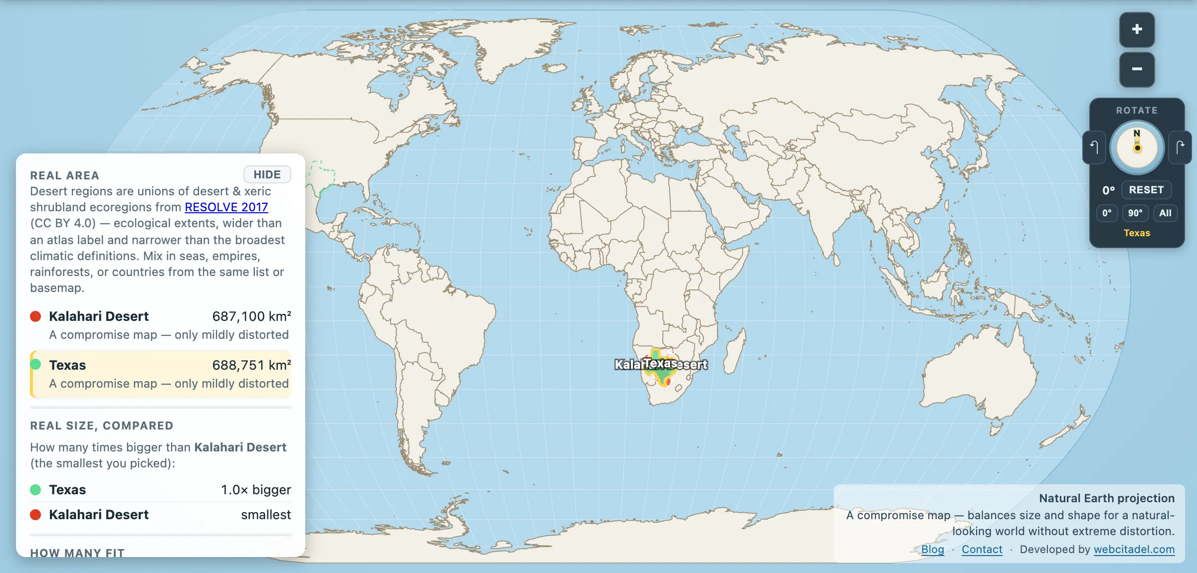
Texas is the American unit of bigness. Everything in the state is measured against it and everything outside the state gets measured by it. So here is a sand basin in southern Africa that matches it almost exactly — and a technicality that makes the whole thing stranger.
Kalahari Desert: 687,100 km². Texas: 688,751 km².
Texas edges it by 1,651 km² — a quarter of one per cent, which on shapes this size is a photo finish. Two of the most confidently oversized places on Earth, and you could not separate them by eye.
And one of them is not, by the definition climatologists actually use, a desert at all.
Too wet to qualify
The working line for a true desert is under 250 mm of rain a year. Much of the Kalahari gets 250 to 500 mm, with the northern reaches pushing higher. That makes it a semi-arid sandveld — grass, scrub, acacia, and in a good year a green surface that would embarrass any Hollywood location scout.
What makes it feel like a desert is not rainfall but drainage. The Kalahari sits on one of the largest continuous sand surfaces on the planet, a basin of wind-blown sand up to hundreds of metres deep laid down over millions of years. Rain lands and vanishes downward. There is no surface water to speak of, no permanent rivers across most of it, and a dry season that strips the place back to sand and thorn. It behaves like a desert while failing the entrance exam.
The delta that goes nowhere
The best evidence that the Kalahari is doing something other than being a desert is sitting in its northern corner. The Okavango rises in the Angolan highlands, runs south-east, crosses into Botswana, and then simply stops — spilling into the sand as an inland delta instead of reaching a sea. Depending on the season and the year it floods anywhere between about 6,000 and 15,000 km².
The timing is the strange part. The flood arrives in the middle of Botswana’s dry season, because the water takes months to travel down from Angola. So the driest weeks of the year are when the delta fills, and the animals that walk in for it are walking into a wetland that exists because it rained a long way away, a long time ago. It was inscribed as a UNESCO World Heritage site on 22 June 2014 — the thousandth on the list, which is a nice piece of timing for a river that never reaches the sea.
Around it sits the Central Kalahari Game Reserve at roughly 52,800 km² — bigger than Denmark, one of the largest protected areas on Earth, and the ancestral land of San communities whose relationship with the Botswanan state over resettlement has been through the courts and is still contested.
The Kalahari’s wildlife has adapted to the same rules as its people: black-maned Kalahari lions, meerkats, gemsbok that can let their body temperature climb rather than waste water sweating.
Drop Texas on the sandveld
Open Kalahari vs Texas on Natural Earth. Texas has been dragged across the Atlantic and laid over Botswana, Namibia and South Africa, where it covers the basin almost exactly — a sliver of Texas over at the edges and nothing you would notice without the readout.
The photo finish is on the Kalahari vs Texas.
This is the same lesson the Alaska comparison teaches from one direction and the France comparison from the other. Texas is genuinely enormous. So is a stretch of southern Africa most people have never had to picture at all.
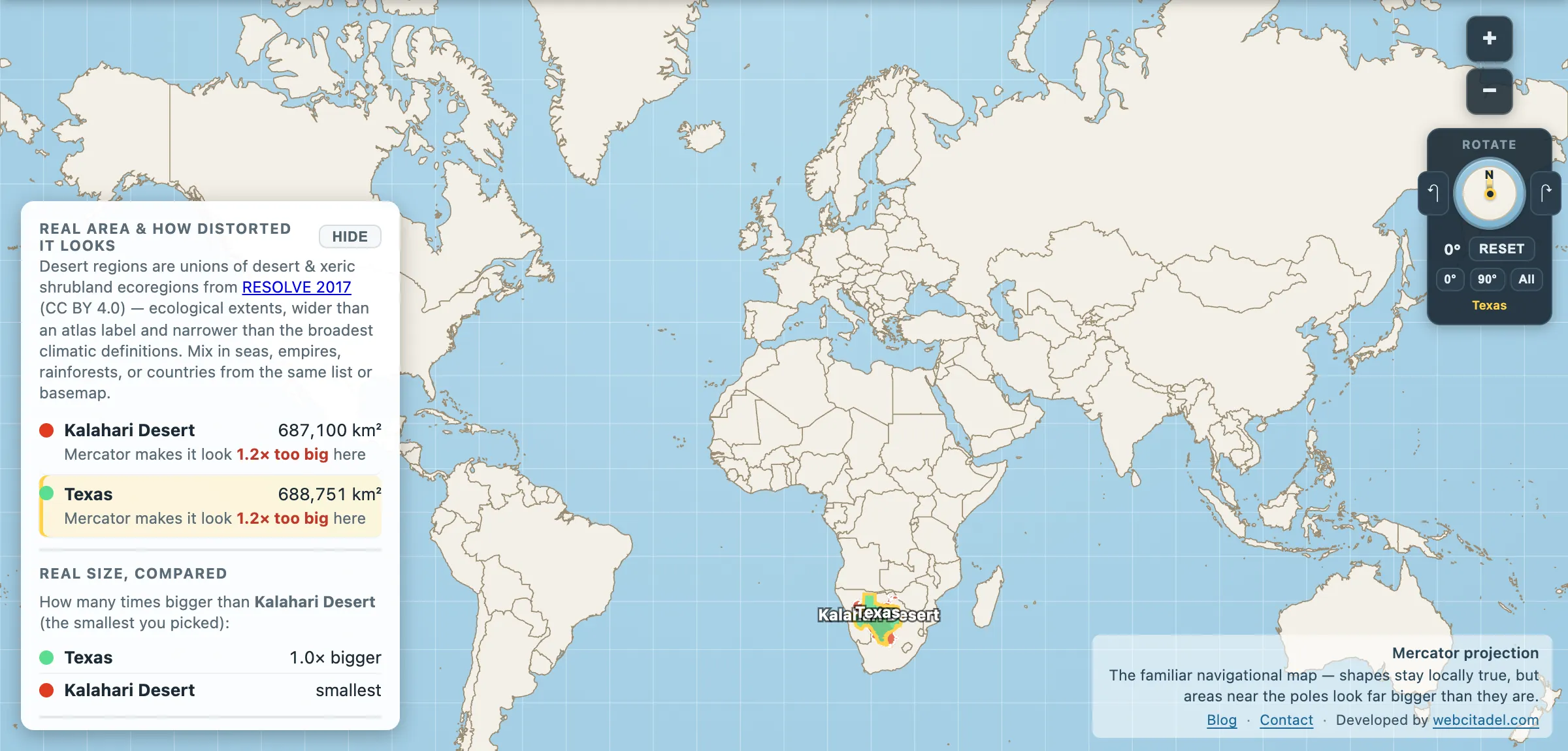
The same shapes on Mercator — the projection almost every map you see uses. Watch what it does to anything far from the equator.
Sources & methodology
- Kalahari outline/area: union of Desert & Xeric Shrubland ecoregions from RESOLVE Ecoregions 2017 (CC BY 4.0), as used in Map Real Size. Broader definitions of the Kalahari Basin — which take in parts of Zambia, Zimbabwe and Angola — run to well over a million km².
- Texas: US state area in the app (688,751 km²).
- Rainfall bands, delta extent and reserve size are widely published figures; the Okavango’s flooded area varies substantially year to year.