
The hottest place on Earth is not in the Sahara. It is not Death Valley, whose claim rests on a 1913 air-temperature reading that meteorologists have been quietly arguing about ever since. It is a stretch of south-eastern Iran that most atlases label, if they label it at all, in six-point grey.
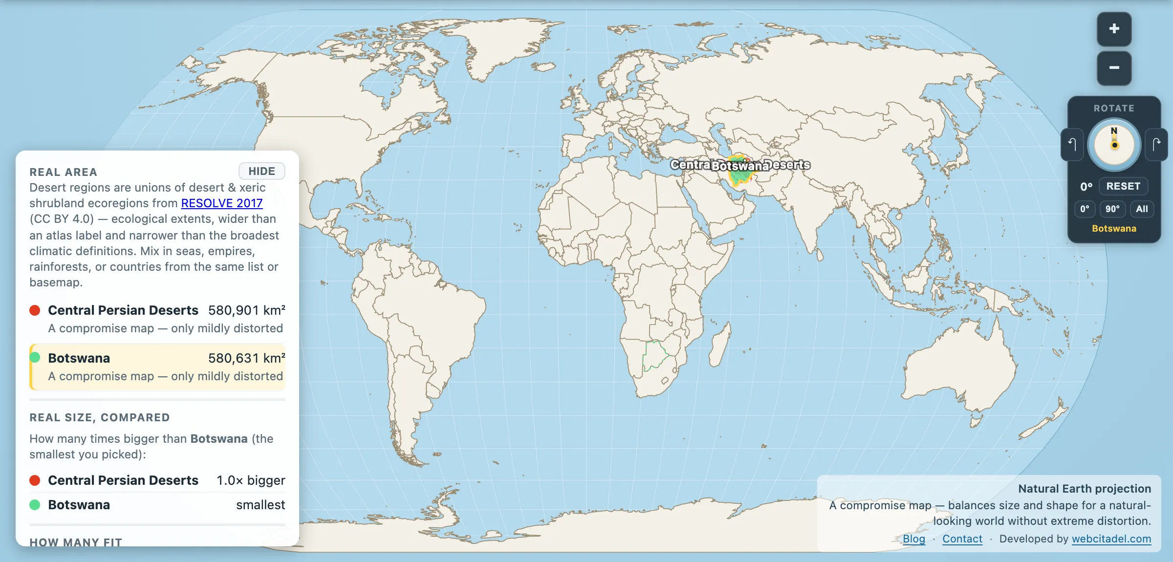
Central Persian Deserts: 580,901 km². Botswana: 580,631 km².
Two hundred and seventy square kilometres apart, out of more than half a million — the tightest match in this app’s desert catalog. And somewhere inside that shape is the hottest ground ever measured on this planet.
80.8 °C, measured from orbit
On 16 July 2018, NASA’s MODIS instrument recorded a land surface temperature in the Lut of 80.8 °C. That is the ground, not the air — the number a satellite reads off the skin of the planet, which runs far hotter than the shaded thermometer in a weather station.
It is the highest reliably measured surface temperature anywhere on Earth, and it beat the previous record — 70.7 °C, also in the Lut, in 2005 — by more than ten degrees, largely because the newer analysis used better methods and finer resolution. Exactly one place has ever matched it: the Sonoran Desert in Mexico, which hit the same 80.8 °C on 12 July 2019. The two deserts are tied, and everywhere else on the planet is a long way behind. The figures come from Zhao and colleagues’ survey of MODIS data from 2002 to 2019, published in the Bulletin of the American Meteorological Society in 2021.
The ground-versus-air distinction is the reason the Lut doesn’t hold the official record. Guinness and the WMO track air temperature, measured properly at 1.5 metres in a ventilated screen — and there is no weather station in the middle of the Lut, because there is nobody in the middle of the Lut. So the desert that reads hottest from space stays off the leaderboard on a technicality of instrumentation, and Death Valley keeps the air-temperature title.
What makes it that hot is a coincidence of geography: a basin ringed by mountains that block moisture, a floor of dark volcanic sand and gravel that soaks up sunlight instead of bouncing it, and almost no vegetation or water to spend the energy on evaporation. The ground has nothing else to do with the heat but hold it.
The kaluts, and a landscape that looks borrowed
The Lut’s signature feature is a field of yardangs — locally kaluts — ridges of sediment carved by wind into parallel corrugations up to 80 metres high, running north to south for well over a hundred kilometres because the wind here has been blowing the same way for a very long time. From above they look like a ploughed field photographed from the wrong altitude. Elsewhere in the basin sit some of the tallest sand pyramids on the planet, dunes measured in hundreds of metres.
In 2016 the Lut became Iran’s first natural UNESCO World Heritage site, on the strength of exactly this: a desert surface so extreme and so undisturbed that it functions as a working laboratory for how wind shapes rock.
Lay a country on the hot floor
Open the Central Persian Deserts with Botswana. Botswana has been dragged from southern Africa onto the Iranian plateau, where it covers the basin system almost exactly.
It is a useful pairing because the two are the same size and share almost nothing else — except, oddly, that Botswana’s own Kalahari is the other great sand basin that isn’t quite a desert. One of these two shapes contains ground measured at 80.8 °C. The other tops out around 44.
Note what you are dragging, though. This is the whole Central Persian basin system, which holds the Dasht-e Lut and the Dasht-e Kavir. The Lut proper is a fraction of it.
For the other end of the desert scale, see the Sahara against the United States.
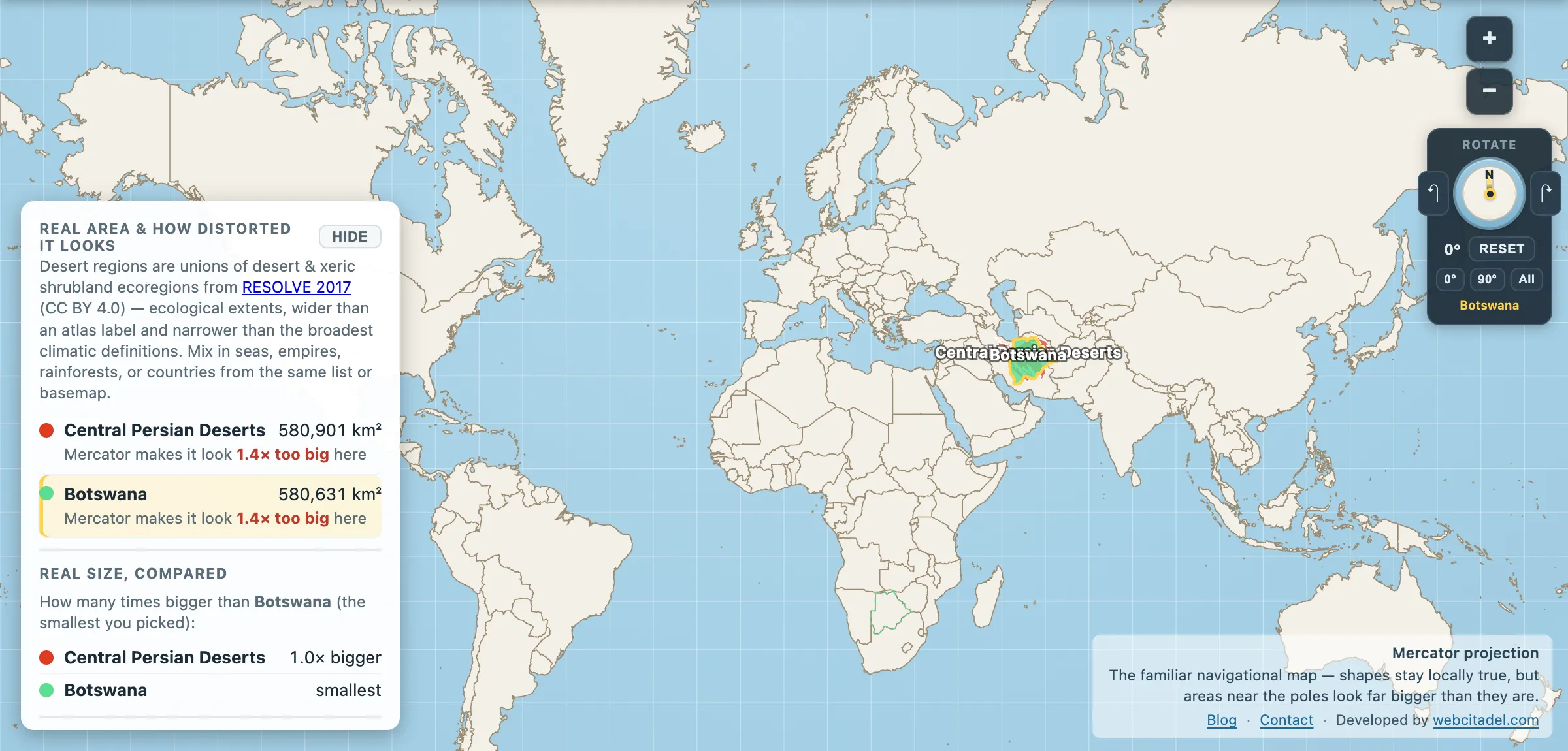
The same shapes on Mercator — the projection almost every map you see uses. Watch what it does to anything far from the equator.
Sources & methodology
- Outline/area: the Central Persian desert basins ecoregion from RESOLVE Ecoregions 2017 (CC BY 4.0), as used in Map Real Size. RESOLVE has no discrete Dasht-e Lut, so the app names this shape for what it actually is rather than mislabelling it. The Lut proper is far smaller — commonly given as roughly 51,800 km² in its core, about the size of Croatia. The 80.8 °C reading belongs to the Lut, not to the whole basin.
- Botswana: country area in the app (580,631 km²).
- Temperature: Zhao et al., “Global Patterns of Hottest, Coldest, and Extreme Diurnal Variability on Earth”, Bulletin of the American Meteorological Society (2021), analysing MODIS land surface temperature data from 2002 to 2019. Land surface temperature is not air temperature and the two are not interchangeable — the WMO air-temperature record remains Death Valley’s 56.7 °C.