
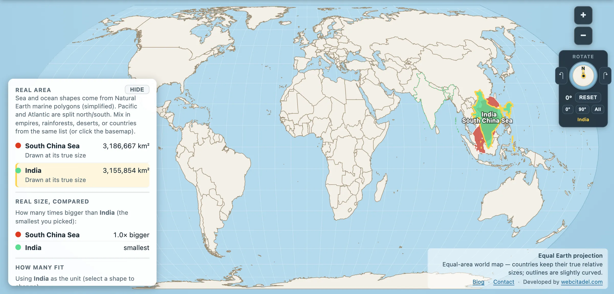
On most world maps the South China Sea is a gap. A blue space between countries, sized by the eye at something like “a large bay” — the bit you cross to get from Vietnam to the Philippines.
South China Sea: 3,186,667 km². India: 3,155,854 km².
It is an India. The gap between the two figures is about 31,000 km², which is a Belgium, on shapes over three million.
A third of the world’s shipping
The reason this particular water is on the news more than any other is a coincidence of geometry. It sits between the Indian Ocean and the Pacific, with the Strait of Malacca at one end, and almost everything moving between Europe, the Middle East, and East Asia goes through it. Estimates of the trade crossing it run to roughly a third of global shipping by value, including the great majority of the energy imports that China, Japan, South Korea and Taiwan run on.
Under it sits oil and gas — the US Energy Information Administration’s estimates have run to around 11 billion barrels of oil and 190 trillion cubic feet of natural gas in proved and probable reserves, with much larger and much more speculative figures quoted by other parties. On top of it sits one of the world’s most important fisheries, feeding tens of millions of people and employing millions more.
Three million square kilometres of water that a great deal of the world economy depends on, drawn on the wall map as a blank.
Why everyone’s claim overlaps
The area is claimed, in whole or in part, by China, Taiwan, Vietnam, the Philippines, Malaysia and Brunei. China’s claim is the broadest, historically depicted by the “nine-dash line” that encloses most of the sea; the other states claim exclusive economic zones measured from their coasts under the UN Convention on the Law of the Sea, which overlap each other as well as the dash line.
The two big island groups are the flashpoints. The Paracels, held by China since 1974 and claimed by Vietnam. The Spratlys, a scatter of reefs and rocks claimed by nearly everyone, several of which have been enlarged by dredging into artificial islands with runways and harbours — a change to physical geography large enough to be visible from orbit.
In 2016 an arbitral tribunal at The Hague, in a case brought by the Philippines under UNCLOS, found that China’s historic-rights claim within the nine-dash line had no legal basis under the convention, and that several features China occupied were rocks or low-tide elevations that generate no exclusive economic zone. China rejected the ruling and did not participate in the proceedings. The award has no enforcement mechanism.
None of that is settled and this post has no view on it. What the map can offer is the scale: this is not a dispute over a bay. It is a dispute over an area the size of India.
Put a subcontinent in the water
Open the South China Sea with India on an equal-area map. India has been dragged off Asia and dropped into the sea, where it fits with very little to spare.
Drag it back and forth. Every time the news says “the South China Sea”, this is the object being discussed.
For the sea that beats it, see the Philippine Sea next door at 5.5 million km² — bigger again, and almost never mentioned.
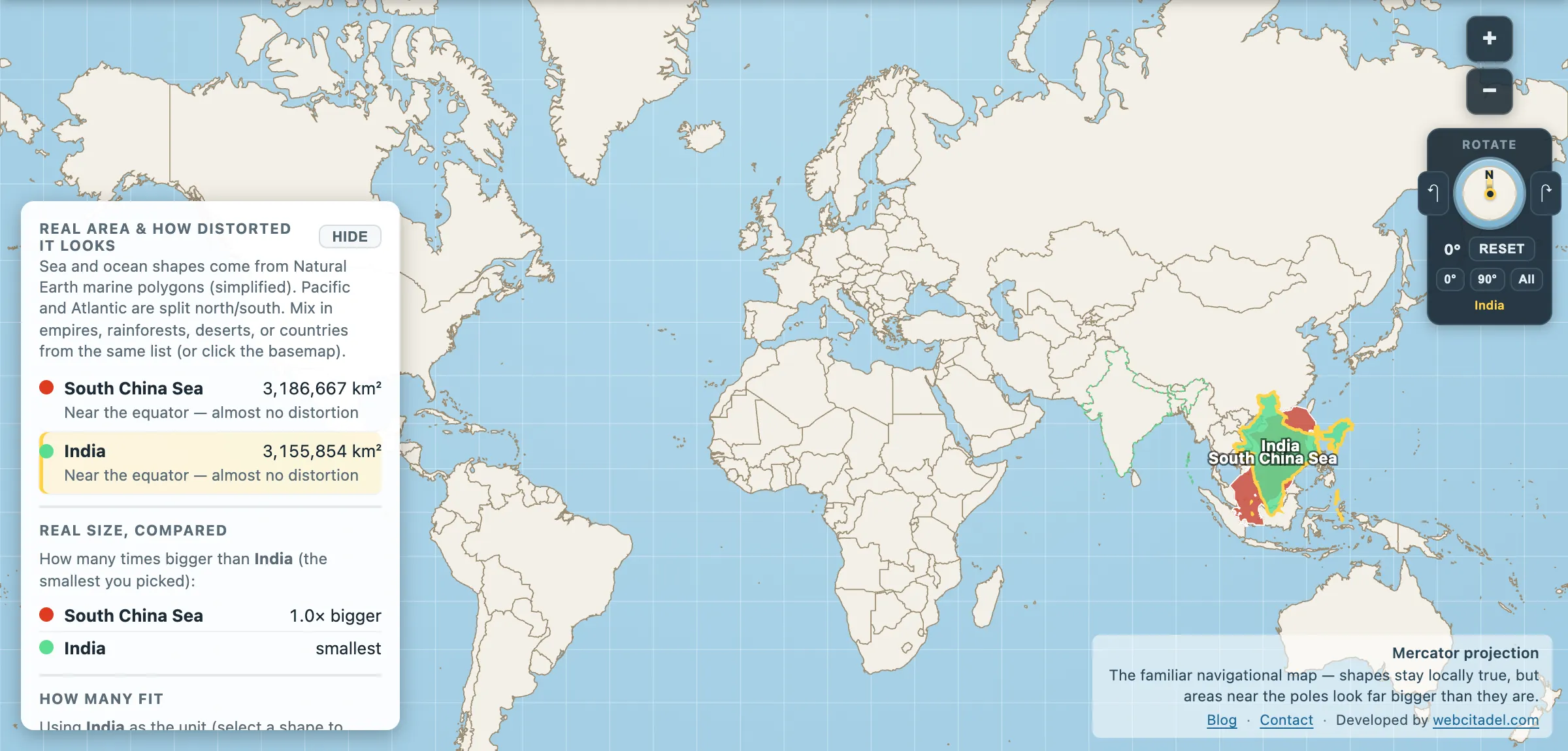
The same shapes on Mercator — the projection almost every map you see uses. Watch what it does to anything far from the equator.
Sources & methodology
- Sea outlines/areas: Natural Earth marine polygons (simplified), as used in Map Real Size. Marine boundaries between named seas are conventions, not physical features, and different authorities draw them differently — the South China Sea is often quoted at around 3.5 million km².
- India: country area in the app (3,155,854 km²).
- Trade share, reserve estimates and the 2016 arbitral award are as reported by the EIA, UNCTAD-style shipping analyses and the Permanent Court of Arbitration record respectively.