
Brazil is the fifth or sixth largest country on Earth depending on how you rank the disputed edges — 8,499,526 km², and nearly four times the Greenland that pretends to outrank it.
Now take one of its twenty-six states.
Amazonas: 1,572,550 km².
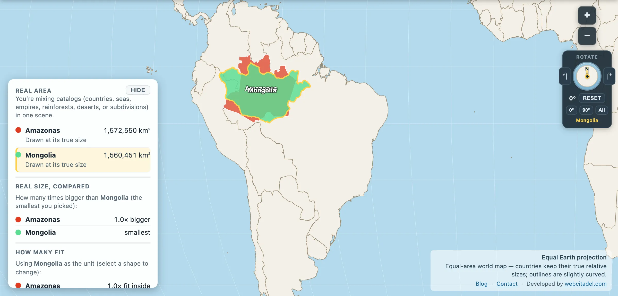
Bigger than Mongolia (1,560,451). Bigger than Alaska (1,518,878). Bigger than Peru (1,296,298), Chad, Mali, Angola and South Africa. It falls just short of Iran, at 1,622,871 km², and that is the company it’s keeping — in the app’s country list only eighteen entries are larger. One Brazilian state, on its own, would sit nineteenth largest country in the world.
It is about 18 per cent of Brazil, and its neighbour Pará adds another 1,232,803 km² on top.
The opera house in the middle of the forest
Manaus sits 1,500 km up the Amazon from the Atlantic, and it has a population well over two million — a city the size of Paris, in the middle of a rainforest, reachable by boat or plane and, historically, not much else.
It is there because of rubber. In the late nineteenth century the Amazon had a global monopoly on natural latex, and Manaus got very rich very quickly. The Teatro Amazonas, opened in 1896, was built with Italian marble, French glass and Scottish ironwork shipped up the river, with a dome of tiles in the Brazilian national colours — an opera house of genuine European ambition, a thousand miles into the interior.
The boom ended almost as fast. Seeds smuggled out to Kew in the 1870s eventually founded plantations in Southeast Asia that could produce rubber more cheaply, and Amazonas’s monopoly evaporated. The theatre remains, and still stages a season.
Just downstream is the Meeting of the Waters, where the black Rio Negro meets the sandy-brown Solimões and the two run side by side, unmixed, for several kilometres — different temperatures, speeds and densities, drawing a visible line down the middle of a river that is already several kilometres wide.
The scale problem this fixes
Everyone knows the Amazon is big. Almost nobody has a mental image of the units it comes in. The forest as a whole is about 70 per cent of the United States, which is a fact that arrives without a handle on it.
Amazonas the state is a handle. One administrative unit, with a governor and a capital and licence plates, that would rank in the world’s top twenty countries by area. Brazil has twenty-six of these, and it has a bigger one next door.
Lose Mongolia in a state
Open Amazonas with Mongolia dragged on top, on an equal-area map. Mongolia — a country with a seat at the UN, a border with two great powers, and a landmass that dominates any map of central Asia — fits inside a Brazilian state.
Swap Mongolia for Alaska, then for Peru. They all go in, and the state that swallows them is one province of one country in one continent.
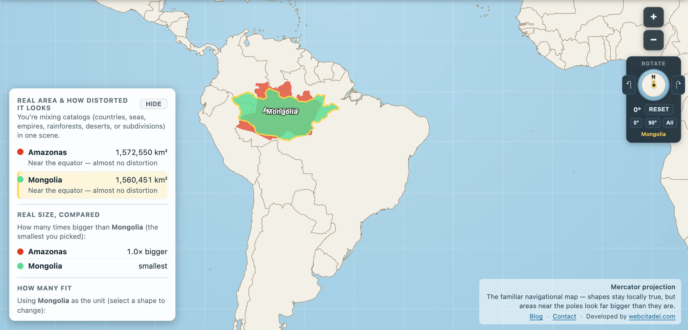
The same shapes on Mercator — the projection almost every map you see uses. Watch what it does to anything far from the equator.
Sources & methodology
- Amazonas and Pará: admin-1 areas computed from Natural Earth 1:50m states and provinces, as used in Map Real Size. Official IBGE figures for Amazonas are around 1.56 million km², consistent with the polygon area here.
- Country areas are from the app’s country dataset; the “nineteenth largest” ranking counts entries in that dataset larger than Amazonas and excludes Antarctica.
- The rubber boom, the Teatro Amazonas and the Meeting of the Waters are standard regional history and geography.