
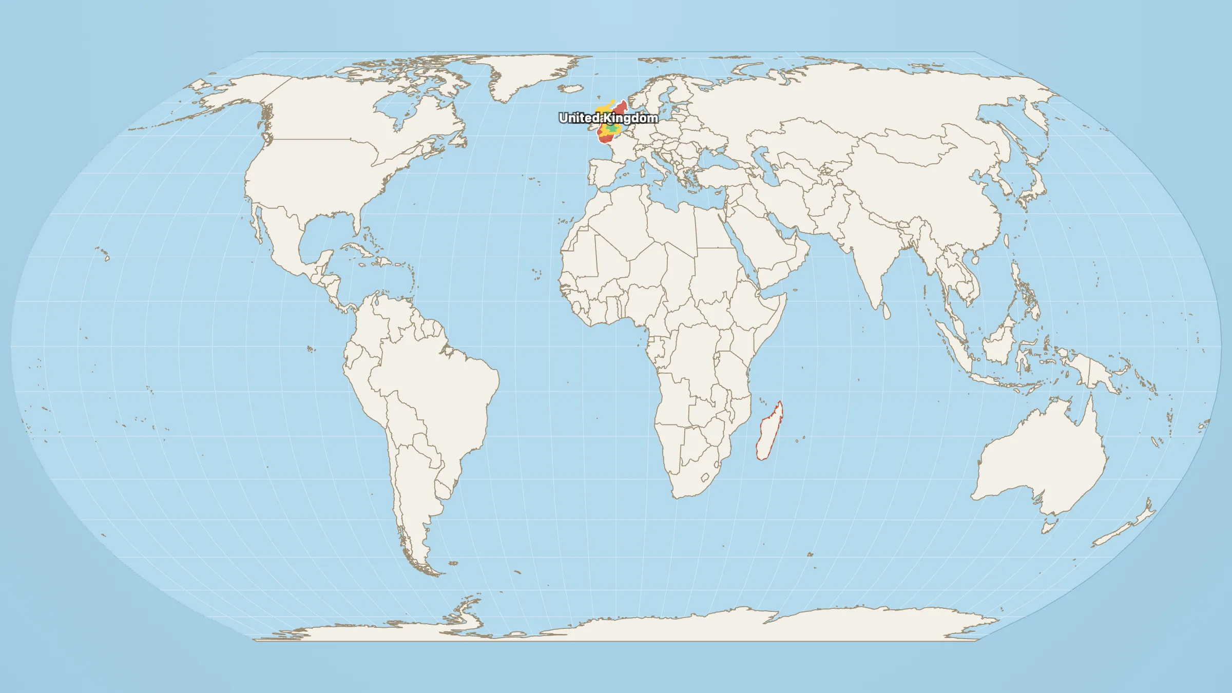
Madagascar, in the popular imagination, is lemurs, baobabs and a cartoon accent. It is “an island off Africa.” Islands are small. That is half the point of calling them islands.
Except this one.
Madagascar: 594,630 km². United Kingdom: 239,619 km².
Madagascar is about 2.5× the UK. Two full United Kingdoms fit inside it, with about 115,000 km² still spare — a bit more than Iceland (101,162 km²). It is also 94% the size of France (635,073 km²): the world’s fourth-largest island is in the same division as the largest country in the EU.
Both shapes, already overlapping, are on Madagascar vs the United Kingdom. The United Kingdom on its own is how big the United Kingdom is.
Why it feels tiny
Partly the word “island.” Partly the map. Madagascar sits near the equator, drawn at honest size, while the UK gets a northern Mercator lift and a starring role on every Europe-centred atlas. Partly culture: Britain exports news; Madagascar exports nature documentaries. Your brain ranks the one with the bigger media machine.
It is still the world’s fourth-largest island, after Greenland, New Guinea and Borneo. About 30 million people live there. The wildlife story is real. The “small island” story is not.
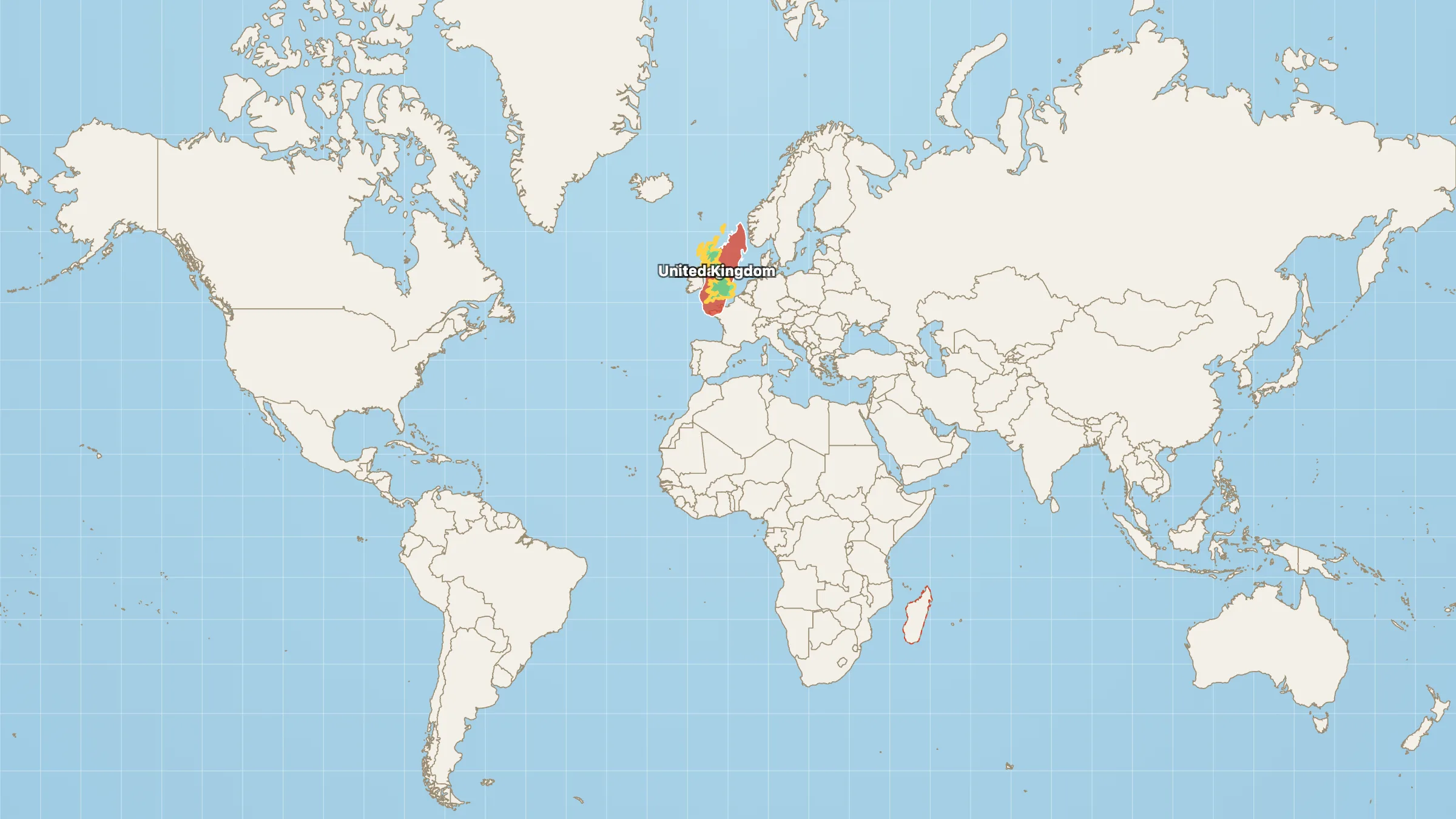
Mercator version. The UK looks a little more substantial. Madagascar does not get smaller — Britain just gets the costume.
Park it on Britain
Open Madagascar next to the UK. Drag the island north and drop it on the British Isles. The UK vanishes inside it. Add France from the picker if you want the near-miss with the hexagon.
Then put the island back in the Indian Ocean, where it is a crumb next to a body of water twice the size of Africa. Small is relative. Madagascar only looked small because the water around it is enormous — and because the map flatters the north.