
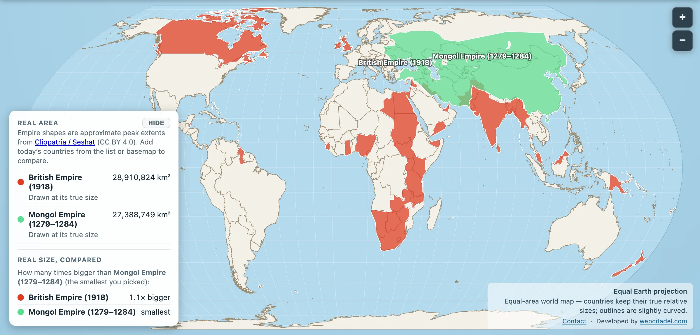
“Largest empire in history” has exactly two serious contenders, and the argument between them has been running in pubs and comment sections for as long as either has existed. It usually generates a lot of heat and no square kilometres. So here are the square kilometres.
- British Empire at its 1918 peak: 28,910,824 km²
- Mongol Empire at its 1279 to 1284 peak: 27,388,749 km²
Britain by a nose. About 1.5 million km² in it, which is roughly one Mongolia of daylight, a detail the universe clearly included as a joke. Each empire, at its height, controlled about a fifth of all land on Earth and roughly a quarter of everyone alive. The British counted around 458 million subjects in the 1920s. The khans ruled over 100 million people in a century when the whole world held perhaps 400.
Same trophy, opposite machines
Put both shapes on one map and the numbers stop being the story.
The Mongol Empire is one unbroken mass, the largest contiguous land empire there has ever been, running from Korea to the edge of Europe. Built in about seventy years from a standing start in 1206, on cavalry, with a relay post system called the yam that could move a message across Asia faster than anything Europe would manage for centuries.
The British Empire is the opposite animal. A scatter of continents and islands, Canada to India to Australia to a corridor of Africa, connected by nothing except the Royal Navy and an ocean of paperwork. The empire on which the sun never set, mostly because it was never in one place. The Spanish coined that phrase first, by the way, and they have a claim to the idea too.
One you could ride across. The other you could only sail between. Same fifth of the planet, six centuries apart.
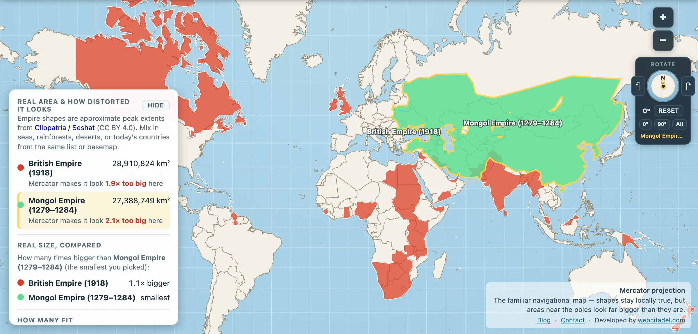
The same shapes on Mercator — the projection almost every map you see uses. Watch what it does to anything far from the equator.
The small print
Historical borders are estimates and peak years are snapshots. Protectorates blur, claims overlap and empires were always mid-expansion or mid-collapse. Treat these shapes as best-effort peak footprints, good enough to settle the pub, not to survey a border.
Open British vs Mongol on an equal-area map and drag them over each other. Then drag either one over the modern world and watch today’s borders shelter under it. That part never stops being strange.