
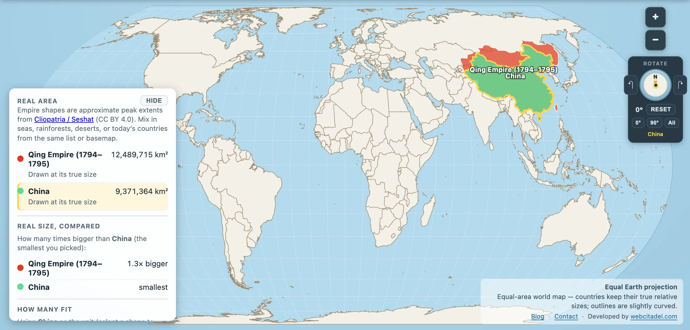
Modern China is the third or fourth largest country on Earth depending on how you count disputed ground, and it is still substantially smaller than it was in 1795.
Qing Empire at its peak: 12,489,715 km². China today: 9,371,364 km².
The Qing held about 33 per cent more — a gap of over three million km², which is roughly an India of difference.
The dynasty that drew the modern map
The Qing were Manchus from the north-east, outsiders who took Beijing in 1644 and then spent a century and a half expanding in every direction a horse could go. Most of what makes China’s outline recognisable today was fixed by them:
- Taiwan, annexed in 1683 after the defeat of the Zheng regime that had held it since 1661 — the first time an imperial Chinese dynasty governed the island.
- Mongolia, absorbed in stages as the Qing broke the Dzungar Khanate.
- Xinjiang, conquered in the 1750s in campaigns that ended the last great steppe power. The name means “new frontier”, which tells you how it was understood at the time.
- Tibet, brought under a Qing protectorate from 1720 with resident commissioners in Lhasa.
By the Qianlong Emperor’s reign, the Qing governed perhaps a third of humanity and an economy that was, on most estimates, the largest in the world. In 1793 the Macartney embassy arrived from Britain to request trade concessions and was sent home with a letter explaining that the Celestial Empire possessed all things and had no use for foreign manufactures. It was arrogant. It was also, at that exact moment, more or less accurate.
Then it went the other way
The Qing’s second century is the map running in reverse, mostly at the point of a treaty:
- The Treaty of Nanking (1842) took Hong Kong island after the First Opium War.
- The Treaty of Aigun (1858) and the Convention of Peking (1860) handed Russia roughly a million km² of Outer Manchuria — the territory that gave Russia the Pacific coast and Vladivostok, and left China’s north-east landlocked from the Sea of Japan.
- Further Russian treaties took stretches of Central Asia.
- The empire fell in 1911–12, and Outer Mongolia declared independence, confirmed in the following decade.
Those losses are the bulk of the three million km² gap. This is why “unequal treaties” remains live political language in China more than a century later: the shrinkage is documented, dated, and signed.
The pattern across the region
The Qing are not alone in outgrowing their successor state. The Russian Empire was a third bigger than modern Russia too — and a fair chunk of what Russia gained, China lost, in the same set of treaties. Two empires shrinking into modern states, with the same frontier between them.
For the outright record, the Mongol Yuan is usually reckoned to have drawn a bigger China still — though the estimates range from 11 to 14 million km², so on the lower ones the Qing keep the title.
See what’s missing
Open the Qing with modern China on an equal-area map. The People’s Republic sits inside the Qing outline. What sticks out around it is Mongolia, Outer Manchuria and the Central Asian margins — the exact shape of the nineteenth century.
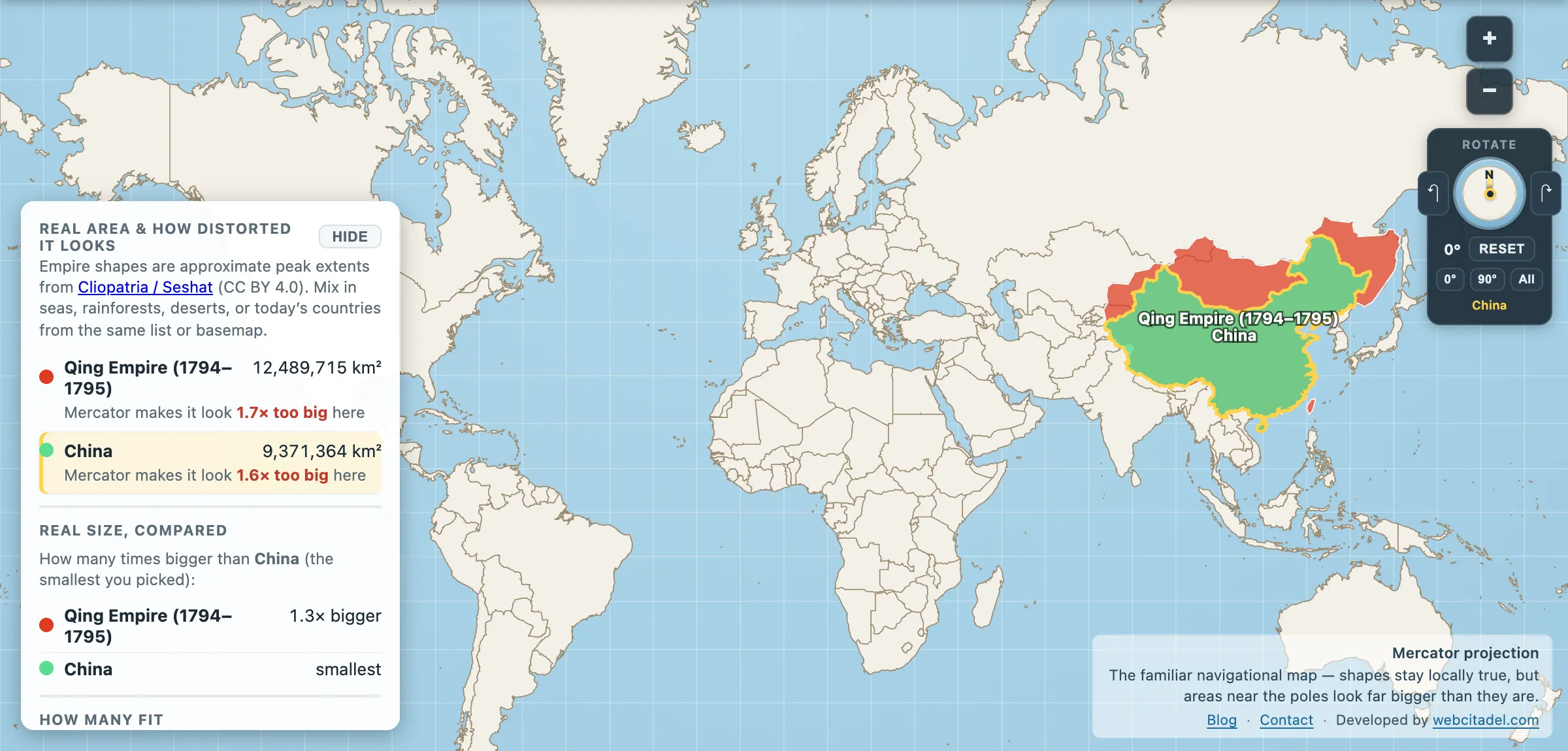
The same shapes on Mercator — the projection almost every map you see uses. Watch what it does to anything far from the equator.
Sources & methodology
- Empire extents: Cliopatria (Seshat Global History Databank), CC BY 4.0, as used in Map Real Size. Figures for the Qing peak vary more than most: the polygon here gives 12.49 million km², Map Real Size’s quiz uses 14.7 million, and mainstream histories generally land at 12–13 million. The lower figure used here is the conservative one — on the quiz’s number the gap with modern China would be wider still. The 1794–1795 window is the dataset’s peak snapshot; Qing territorial claims and effective control were not always the same thing, particularly in the far west and on the Tibetan plateau.
- China: country area in the app (9,371,364 km²), from the source dataset’s boundaries; several of China’s borders are disputed and the number moves with the source.
- Treaty dates and terms are standard diplomatic history.