
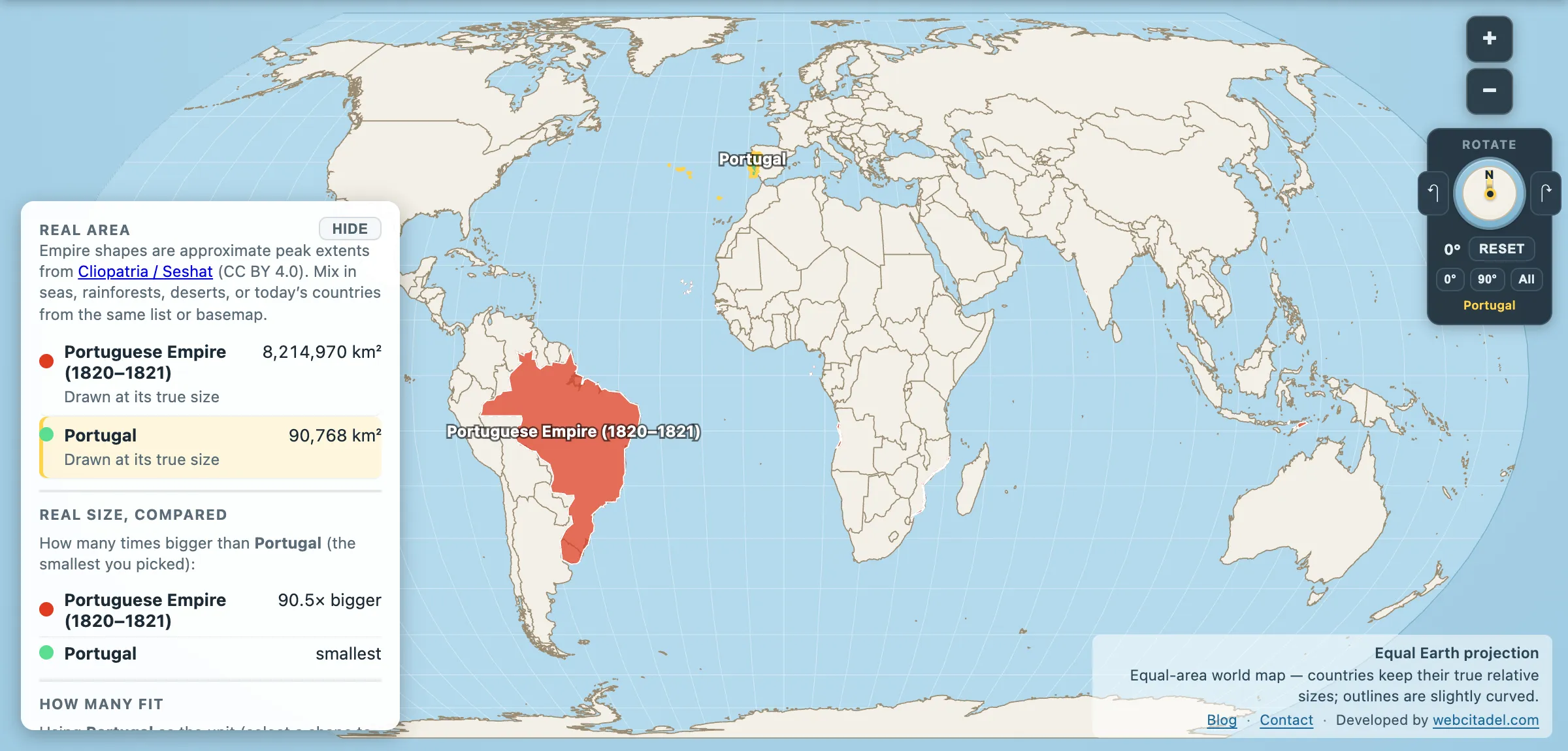
Ranking empires by area is a solved problem. Britain wins, the Mongols come second, everyone else argues about third. We’ve already run that race.
So here’s a different one. Not how big was the empire but how much bigger was it than the country that started it. It’s the ratio that tells you whether you’re looking at a state that expanded, or a small country that got hold of something it had no business holding.
The table
Peak extents from the Cliopatria dataset, homelands measured as the modern country in the app:
| Empire | Peak extent | Homeland | Ratio |
|---|---|---|---|
| British Empire (1918) | 28,910,824 km² | UK — 239,619 km² | 121× |
| Portuguese Empire (1820) | 8,214,970 km² | Portugal — 90,768 km² | 91× |
| Macedonian Empire (323 BC) | 4,946,358 km² | Greece — 130,179 km² | 38× |
| Spanish Empire (1806) | 11,798,077 km² | Spain — 506,185 km² | 23× |
| French colonial empire (1920) | 12,794,865 km² | France — 635,073 km² | 20× |
| Mongol Empire (1279) | 27,388,749 km² | Mongolia — 1,560,451 km² | 18× |
| Roman Empire (117) | 5,265,390 km² | Italy — 300,272 km² | 18× |
| Ottoman Empire (1595) | 4,258,820 km² | Turkey — 779,808 km² | 5.5× |
| Russian Empire (1900) | 22,934,528 km² | Russia — 16,879,951 km² | 1.4× |
What the ratio actually measures
Two completely different machines show up in that table.
The ocean empires sit at the top. Britain at 121×, Portugal at 91×, Spain at 23×, France at 20×. These are small, wet, western-edge countries whose empires were made possible by one technology — the ocean-going ship — and one strategic fact: nobody else was contesting the sea lanes yet. Portugal’s is the purest case. A country the size of Indiana, population somewhere around a million when it started, running trading posts from Brazil to Macau. It could never hold those places in any conventional sense. It held the routes between them, which turned out to be enough for a couple of centuries.
The land empires sit lower, and it isn’t a criticism. The Mongols at 18× took the second-largest empire in history off a homeland that was already huge. Rome at 18× spent four centuries doing what Britain did in one, on foot. The Russian Empire’s 1.4× is the extreme case: Russia mostly is the empire. Expanding east across Siberia didn’t create a metropole and a colony separated by ocean; it created one contiguous state that later spent the twentieth century arguing about whether it had ever been an empire at all.
There’s a third pattern hiding in the Macedonian line. 38× in about a decade, then gone within a generation of Alexander’s death — a ratio that tells you the empire was a campaign rather than a state. Compare Rome’s 18×, built and then administered for four hundred years. High ratio, short life; the two go together more often than not.
The caveat that matters
This is a fun metric, not a serious one, and it deserves saying plainly: the ratio flatters the small. Britain’s 121× and Portugal’s 91× measure the accident of having a small home island as much as they measure achievement. And “homeland” is doing heavy lifting — modern Greece is not Macedon, modern Turkey is not the Ottoman core, and the modern UK is not the England of 1600.
Ratios also say nothing about how many people were governed, how long it lasted, or what it was like to be on the receiving end. An empire 121 times the size of its homeland is a fact about geometry. Everything that made it consequential is somewhere else.
Run it yourself
Open the Portuguese Empire with Portugal on an equal-area map. Portugal is on there. You will have to look for it — it’s about one per cent of the shape it launched.
Then swap in any empire and its modern homeland and watch the ratio change character: some empires are a country that grew, and some are a country that left.
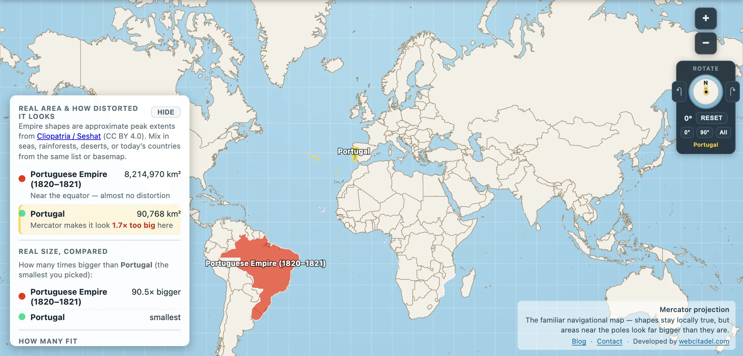
The same shapes on Mercator — the projection almost every map you see uses. Watch what it does to anything far from the equator.
Sources & methodology
- Empire extents: Cliopatria (Seshat Global History Databank), CC BY 4.0, as used in Map Real Size. Peak extents are reconstructions and sources disagree — the conventional figures used in Map Real Size’s own quiz run up to 26 per cent away from these polygons, highest for the British Empire (35.5 million km²), the Abbasids (11.0) and Portugal (10.4).
- The ranking survives that disagreement. On the quiz’s figures the ratios come out as Britain 148×, Portugal 115×, Macedon 40×, Spain 27×, France 18×, Rome 17×, Mongols 15×, Ottomans 7×, Russia 1×. The numbers move; the order barely does, and the two-machines argument doesn’t move at all.
- Homelands: modern country areas in the app, used as a rough proxy. Modern borders are not historical metropole borders.
- Ratios are calculated from the two columns and rounded.