
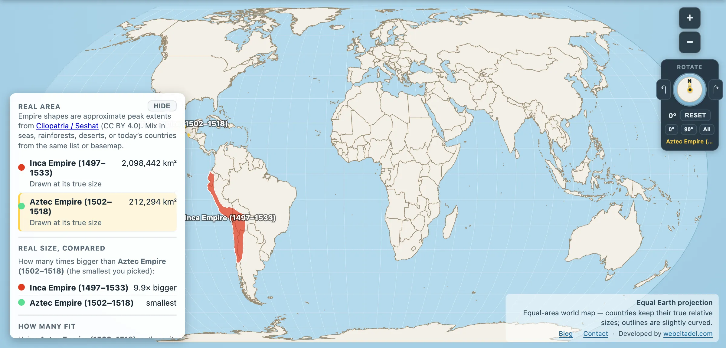
They get shelved together — the two great empires of the pre-Columbian Americas, both wrecked by Spanish expeditions within fifteen years of each other, both filed under the same chapter heading. They never met, they never traded, and on the map they are not remotely in the same category.
- Inca Empire at its peak: 2,098,442 km²
- Aztec Empire at its peak: 212,294 km²
The Inca held nearly ten times as much ground. Put differently: the Aztec Empire was about the size of Belarus. The Inca Empire was about the size of Greenland, spread down 4,000 km of the world’s second-highest mountain range.
Two different ideas of what an empire is
The size gap isn’t a scorecard. It’s a description of two different machines.
The Aztec state — properly the Triple Alliance of Tenochtitlan, Texcoco and Tlacopan, formed in 1428 — was a tribute empire. It didn’t need to administer conquered cities so much as require them to pay, in cotton, cacao, feathers, jade and labour. Conquered rulers frequently stayed in post. The territory is compact because the model was extraction from densely populated valleys, not the occupation of ground.
And what a valley. Tenochtitlan, built on an island in Lake Texcoco, held somewhere between 200,000 and 300,000 people when Cortés arrived in 1519. London at the time had about 50,000. It was fed by chinampas, the raised garden beds in the lake shallows that are among the most productive agricultural systems ever devised, and connected to the shore by causeways with removable bridges. The Spanish who saw it wrote it up in the register of the miraculous, then dismantled it.
The Inca state, Tawantinsuyu — “the four parts together” — was the opposite. It absorbed and reorganised. It moved whole populations (mitmaqkuna) to break up resistance and settle new ground. It took labour as tax under the mit’a system, stored surplus in state warehouses, and bound the whole thing together with Qhapaq Ñan — a road network of more than 30,000 km running from Colombia to Chile, inscribed by UNESCO in 2014 on a joint application from the six countries it still crosses.
It ran that on no wheels, no draught animals capable of pulling much, and no writing system in any form we’ve deciphered. Records were kept on quipu — knotted cord, encoding numbers reliably and possibly more than numbers, still only partly understood. An empire the size of Greenland, administered by knots and runners.
Why they both fell so fast
Neither fell purely to Spanish arms, and the numbers make that obvious: Cortés landed with a few hundred men, Pizarro with fewer than two hundred.
What they had was allies and biology. Cortés’s campaign against Tenochtitlan was fought largely by Tlaxcalan forces — a state the Aztecs had spent decades failing to subdue — with Spanish leadership and a smallpox epidemic that hit the city during the siege. Pizarro arrived in 1532 into the aftermath of a civil war between Atahualpa and Huáscar, itself triggered by the death of their father Huayna Capac in an epidemic that had run ahead of the Europeans down the trade routes.
Two empires with everything invested in the person at the top, caught mid-crisis, by people who had worked out that you capture the emperor first.
Ten Aztecs to an Inca
Open the Inca with the Aztec on an equal-area map. The Aztec Empire is the small dense shape in central Mexico. The Inca Empire is the ribbon down the spine of a continent.
Drag the Aztec outline onto the Inca one and watch it disappear about ten times over. Then remember which of the two you’ve seen more often on a map.
For empires in the same weight class as the Inca, see Rome and Persia — both about two and a half times bigger, with wheels.
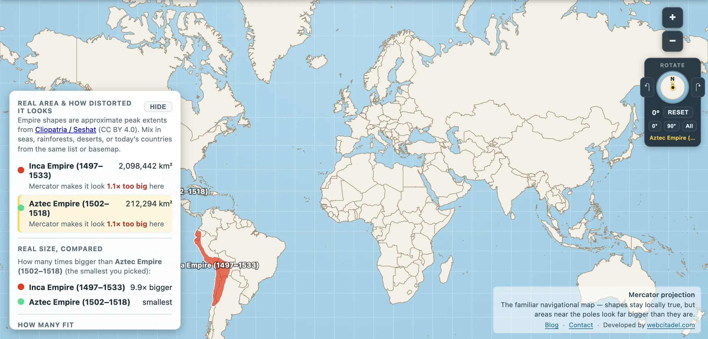
The same shapes on Mercator — the projection almost every map you see uses. Watch what it does to anything far from the equator.
Sources & methodology
- Empire extents: Cliopatria (Seshat Global History Databank), CC BY 4.0, as used in Map Real Size. Map Real Size’s quiz uses a second set of figures giving the Inca 2.0 million km² rather than 2.10; at a tenfold gap, nothing about the comparison moves. Pre-Columbian imperial borders are reconstructions, and the Aztec case is particularly awkward — a tribute network doesn’t have a boundary in the way a territorial state does, so its mapped area depends heavily on how tributary city-states are handled.
- Road network length, city population and the chinampa system are widely published archaeological estimates.