
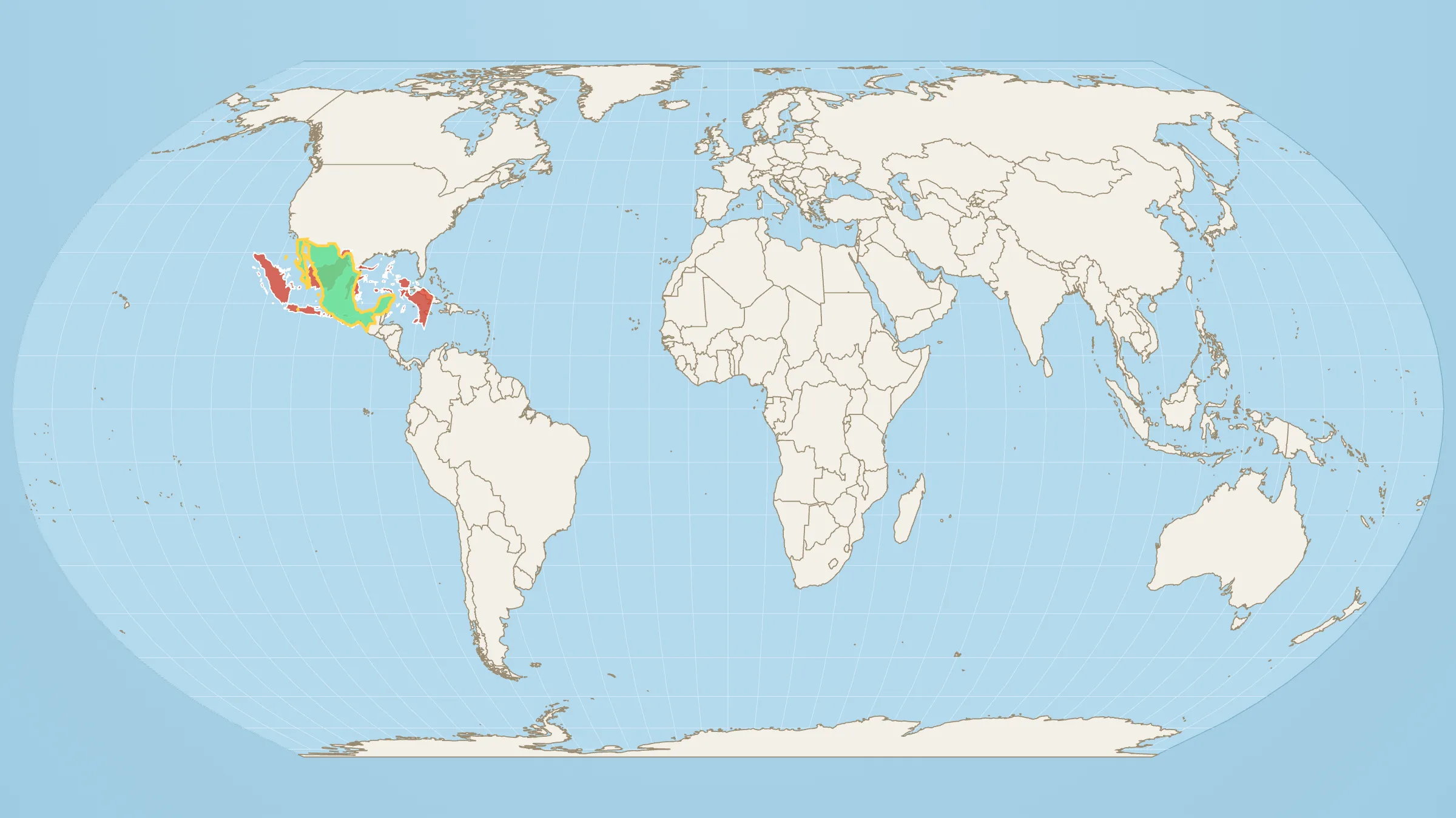
One is roughly 17,000 islands strung along the equator. The other is a single block between the US and Guatemala — desert, highlands, volcanoes, a capital that never sleeps. They do not feel like peers.
They nearly are.
Indonesia: 1,872,270 km². Mexico: 1,962,308 km².
Mexico wins — by about 90,000 km², almost exactly a Portugal (90,768 km²). Call it a photo finish. Two countries filed in completely different mental folders turn out to be the same class of landmass.
The photo finish, with Indonesia already on Mexico, is on Indonesia vs Mexico. Mexico on its own is how big Mexico is.
Why Indonesia looks smaller
Mercator plays a part. Indonesia hugs the equator, so the classroom map draws it close to truth. Mexico sits high enough to pick up a little northern stretch. The bigger effect is shape: Indonesia is scattered — Sumatra, Java, Borneo (shared), Sulawesi, New Guinea (shared), plus thousands of islands that read as decoration. Mexico is one solid colour on the atlas. Solid colours look bigger than archipelagos even when the hectares say otherwise.
Indonesia is also the world’s fourth most populous country — about 280 million people — which somehow still does not register as “large country” the way a single bold outline does. Population and land are different sports. This post is only about land.
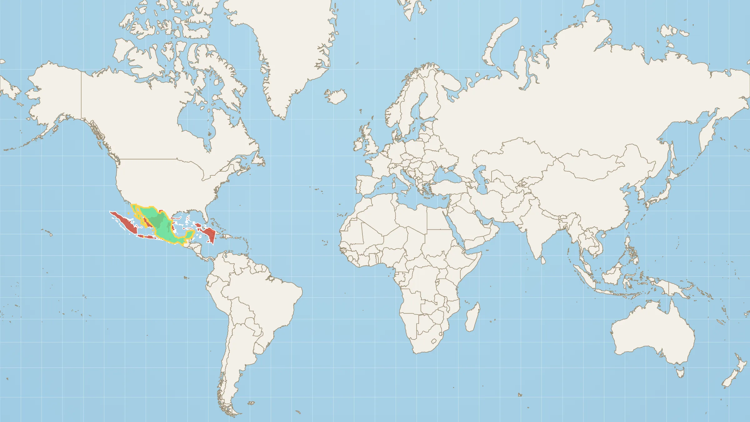
On Mercator, Mexico gains a little visual swagger. Equal Earth is the fairer weigh-in.
Stack them
Open Indonesia on Mexico. Drag the archipelago onto the Mexican outline and watch it cover most of the country. The leftover is real — it is just not a different league.
Then drop either shape onto Western Australia (2.53 million km²) if you want the next rung up. Indonesia and Mexico are not small. They got filed under the wrong adjectives.