
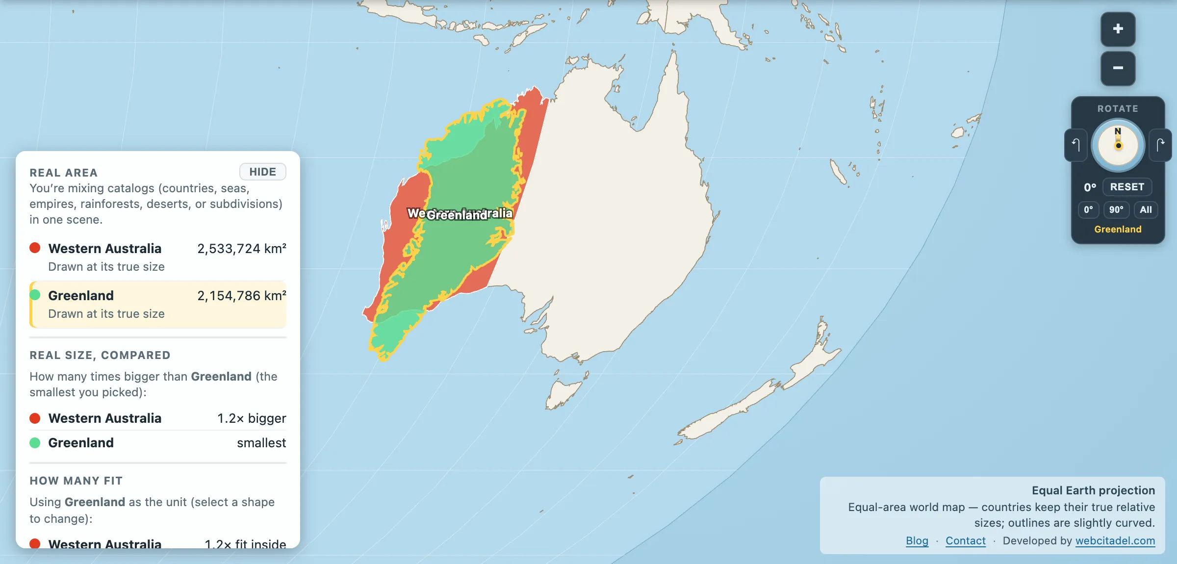
Australia gets drawn small. That’s the running theme of the continent’s own entry on this site — 7.7 million km², wider than the Moon, and still filed mentally somewhere near “a big island”.
So work down a level. Not the country. One state.
Western Australia: 2,533,724 km².
Bigger than Greenland (2,154,786). Bigger than Algeria (2,322,822) and the Dem. Rep. Congo (2,334,737) — Africa’s two biggest countries in this map’s numbers. Bigger than Mexico, Saudi Arabia and Indonesia. In the app’s country list only nine countries are larger — which would make Western Australia, on its own, roughly the tenth largest country on Earth.
It has a population of about 2.9 million, and around 80 per cent of them live in one city.
The most isolated big city in the world
Perth is routinely described as the most remote major city on the planet, and the geography backs the boast. The nearest Australian city of comparable size is Adelaide, about 2,100 km away — further than London to Moscow. Everything between is mostly the state itself.
The Nullarbor crossing to the east includes the longest straight stretch of railway track anywhere: 478 km without a curve. The name means “no trees”, which is Latin doing the work of a full geographical survey.
Then there’s the state’s oddest constitutional fact. In 1933, Western Australia voted in a referendum to secede from the Commonwealth of Australia — 66.2 per cent in favour, on a turnout of 91.6 per cent. Almost exactly two to one, with almost everybody voting.
Nothing happened. A delegation took the case to Westminster in 1935, where a Select Committee recommended that the Imperial Parliament had no business intervening in a dispute between Perth and Canberra, and the matter was dropped. Two and a half million square kilometres voted to leave a country and stayed in it anyway.
What’s actually out there
- The Pilbara, one of the great iron-ore provinces on Earth, running some of the largest and most automated mining operations anywhere — driverless trucks, driverless trains, a control room in Perth 1,500 km away.
- Shark Bay, where the stromatolites at Hamelin Pool are living structures built by cyanobacteria — the same kind of organism that first oxygenated the atmosphere, still doing it, in shallow water you can walk beside.
- The Kimberley in the north: a monsoon-drenched sandstone plateau with gorges, tides among the largest in the world, and rock art traditions running back many thousands of years.
- The Canning Stock Route, 1,850 km of desert track built to move cattle in 1910, now one of the most demanding vehicle routes in the world.
And the emptiness is real. Population density across the state works out at roughly one person per square kilometre, and outside the south-west corner it is a great deal less than that.
Put Greenland in a state
Open Western Australia with Greenland dragged on top, on an equal-area map so both are drawn honestly. The same pair, with the gap, is on Western Australia vs Greenland.
Greenland fits inside the state. It’s the shape our brains file as continent-scale — Mercator’s favourite child, the island that poses as bigger than Brazil — and one Australian state covers it with 380,000 km² to spare.
Try the same trick with Alaska, Mongolia or Saudi Arabia. They all go in.
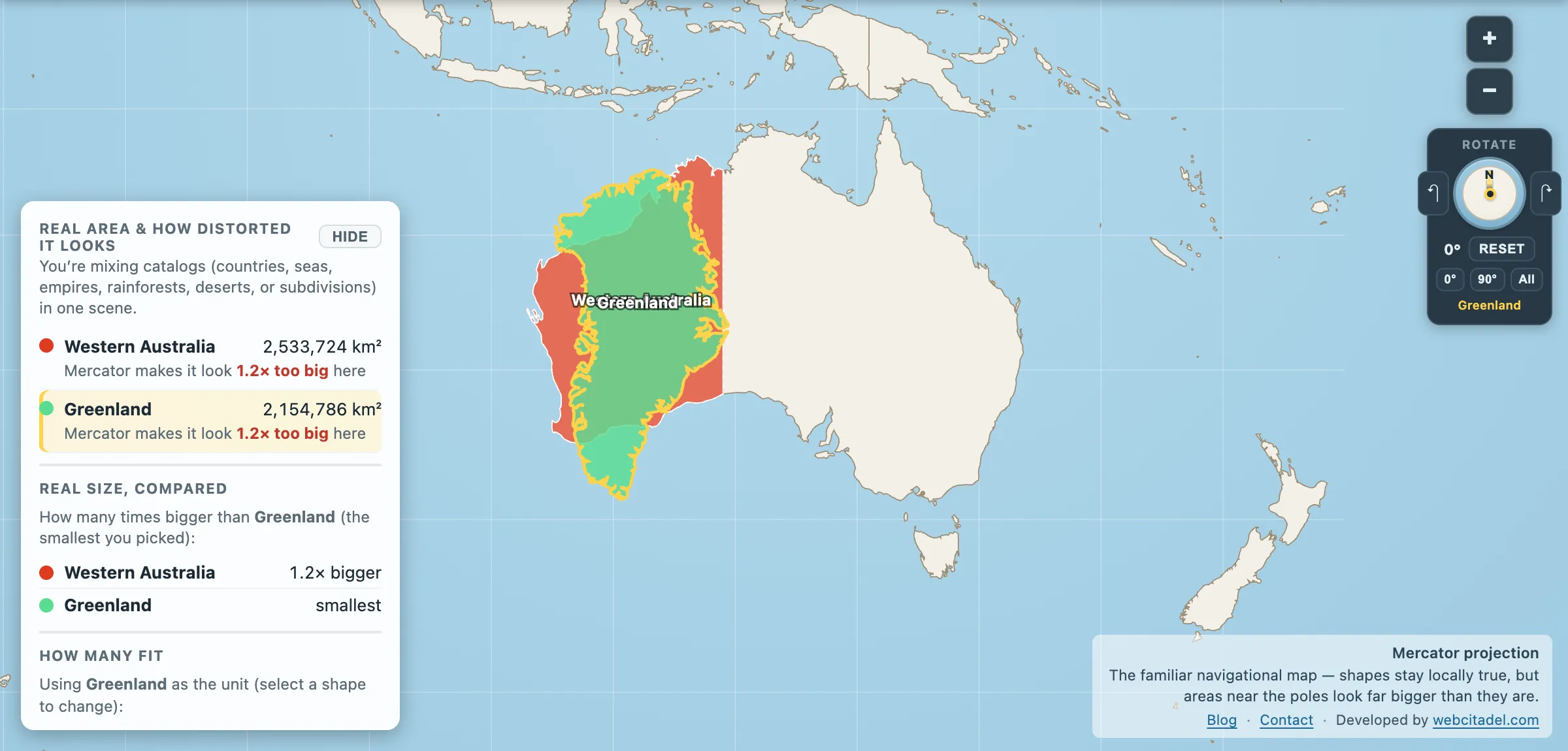
The same shapes on Mercator — the projection almost every map you see uses. Watch what it does to anything far from the equator.
Sources & methodology
- Western Australia: admin-1 area computed from Natural Earth 1:50m states and provinces, as used in Map Real Size (2,533,724 km²). Official Australian figures for the state’s area are around 2.53 million km², which agrees closely.
- Country areas are from the app’s country dataset. The “tenth largest” ranking counts sovereign countries in that dataset and excludes Antarctica; Greenland is counted separately from Denmark, as the source data does.
- The 1933 secession referendum, the Nullarbor straight and Shark Bay’s stromatolites are documented historical and geographic facts.