
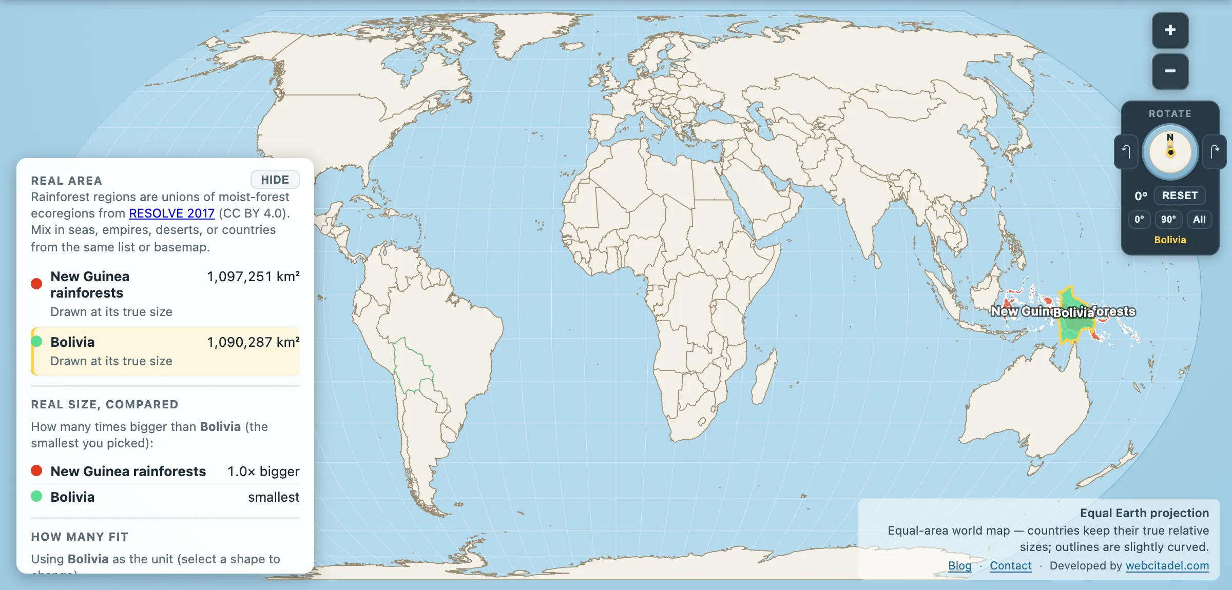
The Amazon and the Congo get the documentaries. The third great block of tropical forest on the planet sits on one island north of Australia, and its main claim to fame in most people’s minds is that it’s shaped a bit like a bird.
New Guinea rainforests: 1,097,251 km². Bolivia: 1,090,287 km².
Within 7,000 km² of each other — a rounding error at this scale. A single island holds a forest the size of a large South American country.
The most diverse island flora on Earth
In 2020 a collaboration of 99 botanists from 56 institutions published the first expert-verified checklist of New Guinea’s vascular plants in Nature, working through more than 23,000 plant names drawn from over 700,000 specimens collected since the 1750s. The verified total: 13,634 species, 68 per cent of them found nowhere else.
That makes New Guinea the most floristically diverse island in the world, and not narrowly — Madagascar comes second on 11,832 species, Borneo third on 11,165, Sumatra fourth on 8,391.
The paper also noted the obvious corollary: the rate of new species descriptions has not slowed down, which means the real number is higher and nobody knows by how much.
The fauna keeps pace. Tree kangaroos — marsupials that went back up into the canopy. Echidnas. Cassowaries. Around 40 species of birds of paradise, whose plumage funded a European trade in skins so lucrative that for decades the specimens arriving in Europe had their feet removed, prompting a genuine belief that the birds never landed.
Eight hundred languages
The human diversity runs the same way and for the same reason. Papua New Guinea alone has around 840 living languages — the most linguistically diverse country on Earth. That is close to 12 per cent of all the languages in the world, spoken by about 0.1 per cent of the world’s people. Add the Indonesian half of the island and the total goes higher.
The precise number moves, and honestly so: Ethnologue’s own totals have sat at 839, 840 and 841 across recent editions, because mutual intelligibility, shared vocabulary and what speakers call their own language do not always point the same way.
The cause is the terrain. A spine of mountains runs the length of New Guinea, cutting valleys off from each other so completely that communities a day’s walk apart developed unrelated languages and stayed that way for thousands of years. Agriculture in the highlands at Kuk Swamp goes back around 7,000 to 10,000 years, making it one of the few places in the world where farming was invented independently rather than imported.
Glaciers on the equator
The mountains do one more improbable thing. Puncak Jaya, in the Indonesian province of Papua, reaches 4,884 m — the highest peak between the Himalayas and the Andes, and the highest island mountain on Earth. Until recently it carried glaciers, four degrees from the equator.
They are nearly gone. Glacier cover on Puncak Jaya is down more than 99 per cent since 1850, and around 65 per cent in the few years after 2018 alone. The two survivors are projected to vanish by about 2030 — some estimates said sooner. Below the same mountain sits Grasberg, one of the largest gold and copper mines in the world.
That’s New Guinea in one view: tropical glaciers, an open-pit mine, and beneath both the largest intact tract of tropical forest left anywhere in the Asia-Pacific — still substantially unlogged, in a way that Borneo and Sumatra no longer are.
Drop Bolivia in the forest
Open New Guinea’s rainforests with Bolivia dragged on top. The two shapes are near enough identical in area, which is hard to believe when one is a country you can name the capital of and the other is a green smear on the edge of most maps.
Then check the neighbours: Sundaland to the west, the Southeast Asian mainland forests beyond it, and the two giants everyone starts with.
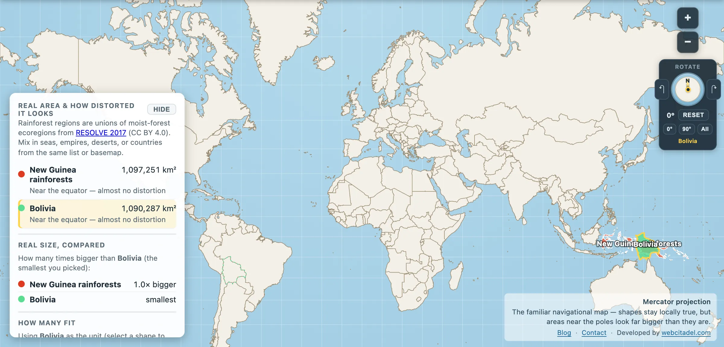
The same shapes on Mercator — the projection almost every map you see uses. Watch what it does to anything far from the equator.
Sources & methodology
- Rainforest regions are unions of moist-forest ecoregions from RESOLVE 2017 (CC BY 4.0), as used in Map Real Size. These are ecoregion boundaries rather than current canopy cover, though New Guinea’s forests remain among the least converted of any major tropical region.
- Bolivia: country area in the app (1,090,287 km²).
- The plant species count is from the 2020 expert checklist published in Nature; language counts follow Ethnologue-style catalogues and vary with how dialects are classified.