
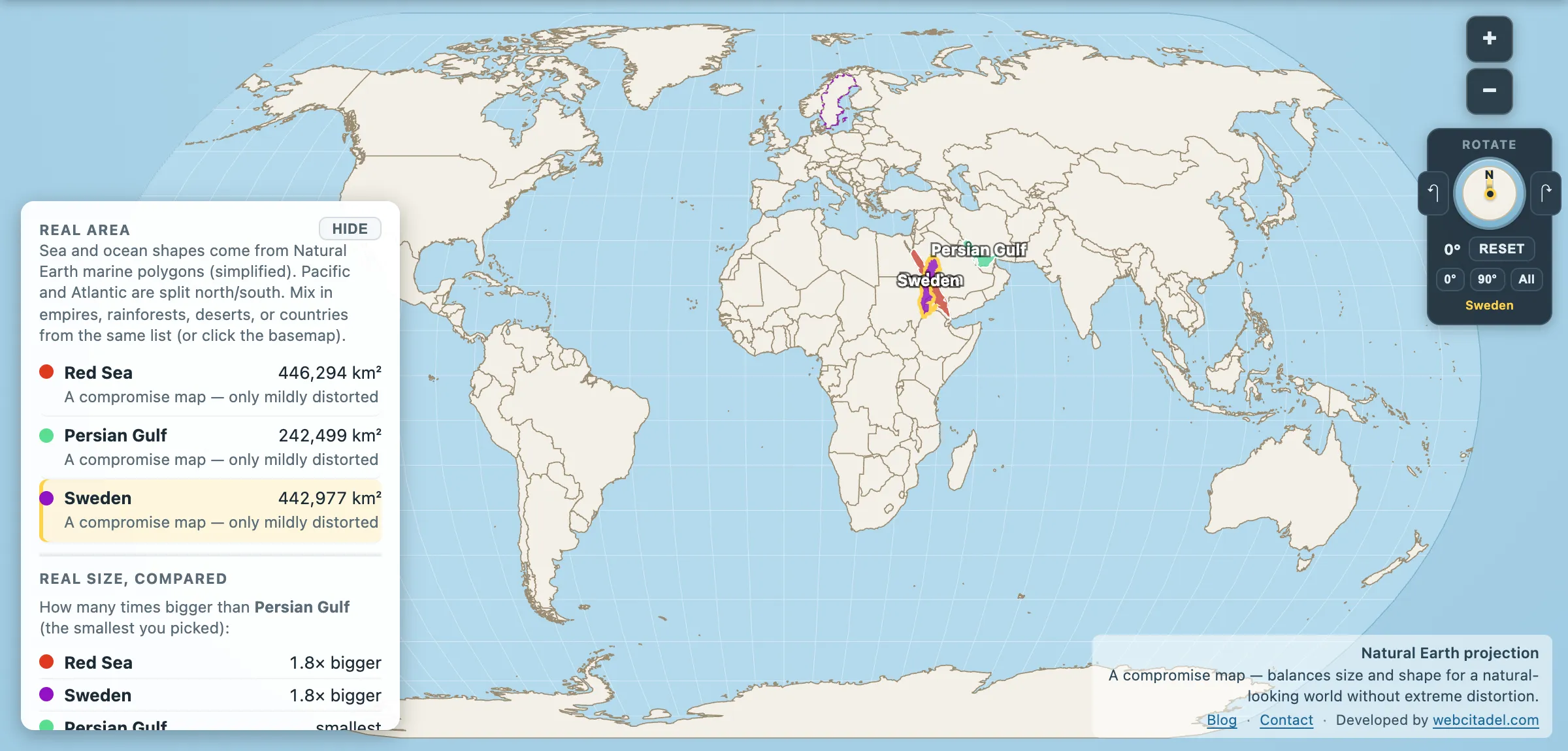
There are two seas on Earth where a closure lasting weeks would be felt in the price of everything, everywhere. Neither is large. That is the unsettling part.
- Red Sea: 446,294 km² — Sweden is 442,977 km²
- Persian Gulf: 242,499 km² — the United Kingdom is 239,619 km²
Two seas, each about the size of one mid-sized European country. And the world economy is threaded through both of them at points a few kilometres wide.
The Persian Gulf: a puddle with a chokepoint
The Persian Gulf is astonishingly shallow. Average depth around 50 metres, maximum around 90. If you drained the Mediterranean’s average depth into it you’d be nowhere close. It is, geologically, a flooded river valley — the Tigris and Euphrates ran out across this floor when sea levels were lower, and it has only been a sea in its current form for a few thousand years.
Out of it runs the Strait of Hormuz, about 33 km wide at its narrowest, with usable shipping lanes narrower still. In a normal year it carries on the order of 20 million barrels of oil a day — roughly a fifth of global petroleum liquids consumption — plus a large share of the world’s LNG. There is no comparable alternative route for most of that volume; the pipelines that bypass Hormuz can take a fraction of it.
How fragile that is stopped being hypothetical recently. Volumes through the strait fell close to 30 per cent year on year in early 2026, to around 14.6 million barrels a day, as conflict disrupted the route. A fifth of the world’s oil depends on a channel you could see across on a clear day.
That is the entire reason the Gulf has been a permanent item on the world’s security agenda for fifty years. Not the size of the sea. The width of the door.
The Red Sea: an ocean being born
The Red Sea’s chokepoint is Bab el-Mandeb — the Gate of Tears — around 30 km wide at the southern end, with the Suez Canal at the north. Between them runs something in the region of 10 to 15 per cent of global trade by volume, and a much higher share of the Europe–Asia container traffic that a great deal of modern manufacturing assumes will keep moving.
Physically it is the most interesting sea on this list, because it is an ocean in the process of opening. The Red Sea sits on a spreading rift where the Arabian plate is pulling away from Africa at roughly a centimetre or two a year. Give it another ten or twenty million years and it will be a proper ocean basin. It is the Atlantic, caught at the stage the Atlantic was at 150 million years ago, and we happen to be alive for it.
It is also one of the warmest and saltiest seas on Earth — around 40 parts per thousand, against the ocean’s 35, because it barely rains here, rivers don’t reach it and the evaporation is relentless. Its corals have become a subject of intense research for exactly that reason: reefs in the northern Red Sea appear unusually tolerant of heat compared with reefs elsewhere, which may make them one of the few refuges left as other reef systems bleach.
Shrink them to scale
Open the Red Sea and the Persian Gulf with Sweden dragged down onto the Red Sea. Sweden covers it almost exactly. Then drag Sweden east and watch it swallow the Persian Gulf with most of itself left over.
That’s the point worth sitting with. We are used to strategic importance and physical size being related. Here they aren’t at all: two seas that would fit inside Scandinavia, holding up a meaningful fraction of the world’s energy and freight.
For a sea in the other direction entirely, see the Mediterranean at two and a half Frances — the water these two feed into.
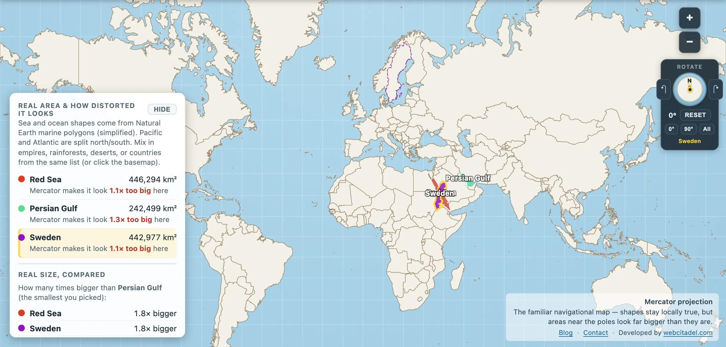
The same shapes on Mercator — the projection almost every map you see uses. Watch what it does to anything far from the equator.
Sources & methodology
- Sea outlines/areas: Natural Earth marine polygons (simplified), as used in Map Real Size. The Red Sea is commonly quoted at around 438,000 km² and the Persian Gulf at around 251,000 km²; boundaries at the straits are conventions.
- Sweden, United Kingdom: country areas in the app.
- Oil transit through Hormuz is from EIA chokepoint reporting and moves year to year; Suez trade share is a widely reported estimate that varies with the source and the year — traffic through both routes has been materially disrupted at various points and these are long-run averages, not current readings.