
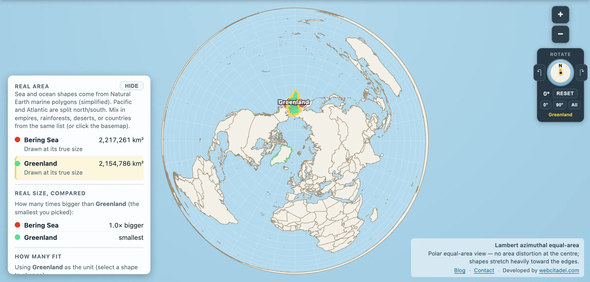
Greenland is this site’s usual defendant. It is the shape Mercator flatters most, the island that isn’t remotely the size of Brazil, the reason people think the Arctic is mostly land.
Here’s a body of water that beats it anyway, at Greenland’s real size.
Bering Sea: 2,217,261 km². Greenland: 2,154,786 km².
The sea wins by about 62,000 km², roughly a Latvia.
It used to be a continent
For long stretches of the last ice age, when enough of the world’s water was locked up in ice sheets to drop sea level by more than 100 metres, the shallow northern shelf of this sea was dry land. Beringia was not a bridge in the narrow sense — it was a plain up to a thousand kilometres wide, with grass, animals and people living on it for generations.
That’s the correction the phrase “land bridge” invites: nobody hurried across it. People lived there, in a place that no longer exists, and the rising sea drowned the homeland rather than the crossing. The peopling of the Americas — a long argument about dates, coastal routes and genetics that is still very much running — starts on a landmass currently under a couple of hundred feet of water.
Today the crossing is about 82 km wide at the Bering Strait. In the middle sit the Diomede Islands, Big Diomede (Russia) and Little Diomede (USA), 3.8 km apart with the International Date Line between them. Locally: Tomorrow Island and Yesterday Isle.
The gap is not quite the full day the nickname implies — local time zones put Big Diomede 21 hours ahead of Little Diomede, 20 in summer. Close enough. On a clear day you can stand on one and look across two and a half miles of water at a different date.
The most productive cold water on Earth
The Bering Sea’s broad shallow shelf, seasonal ice edge and nutrient upwelling make it one of the great fisheries on the planet. Alaska pollock taken here is consistently one of the largest single-species fisheries in the world by volume, and if you have ever eaten a fish finger or a fast-food fish sandwich, this sea has a reasonable claim on the contents.
It is also, seasonally, one of the worst places to work. The Bering is where the storms of the North Pacific go to arrive somewhere, and the winter crab fleet’s casualty rates made it briefly famous on television.
The ice is the part that’s changing fastest. Winter sea-ice extent here has hit record lows in recent years, which moves the ice edge, the plankton bloom timing and the fish with it — a change with immediate consequences for the Yupik and Iñupiat communities on both coasts who hunt from that ice.
Sink Greenland in it
Open the Bering Sea with Greenland on a polar equal-area projection, which is the only honest way to look at anything above 60° north. Greenland has been dragged across the Arctic and dropped between Alaska and Kamchatka. It fits inside, with sea showing around the edges.
Try that on Mercator and Greenland arrives the size of Africa. That’s the whole lesson of this site in one drag: the projection, not the island, is doing the talking.
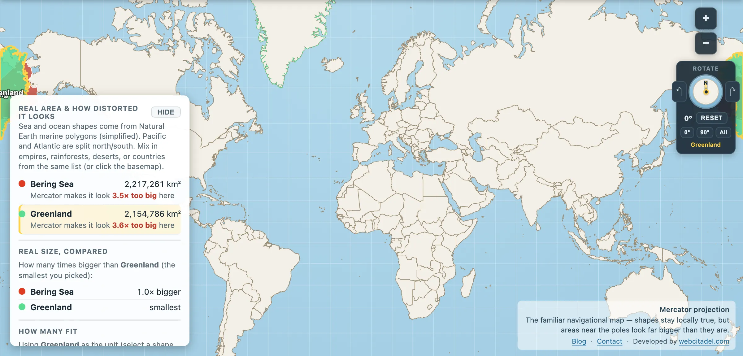
The same shapes on Mercator — the projection almost every map you see uses. Watch what it does to anything far from the equator.
Sources & methodology
- Sea outlines/areas: Natural Earth marine polygons (simplified), as used in Map Real Size. The Bering Sea’s boundary with the North Pacific is a convention; figures elsewhere commonly run around 2.0–2.3 million km².
- Greenland: area in the app (2,154,786 km²).
- Beringia, the Diomedes and the pollock fishery are standard published geography; the dates and routes of the peopling of the Americas remain actively debated.