
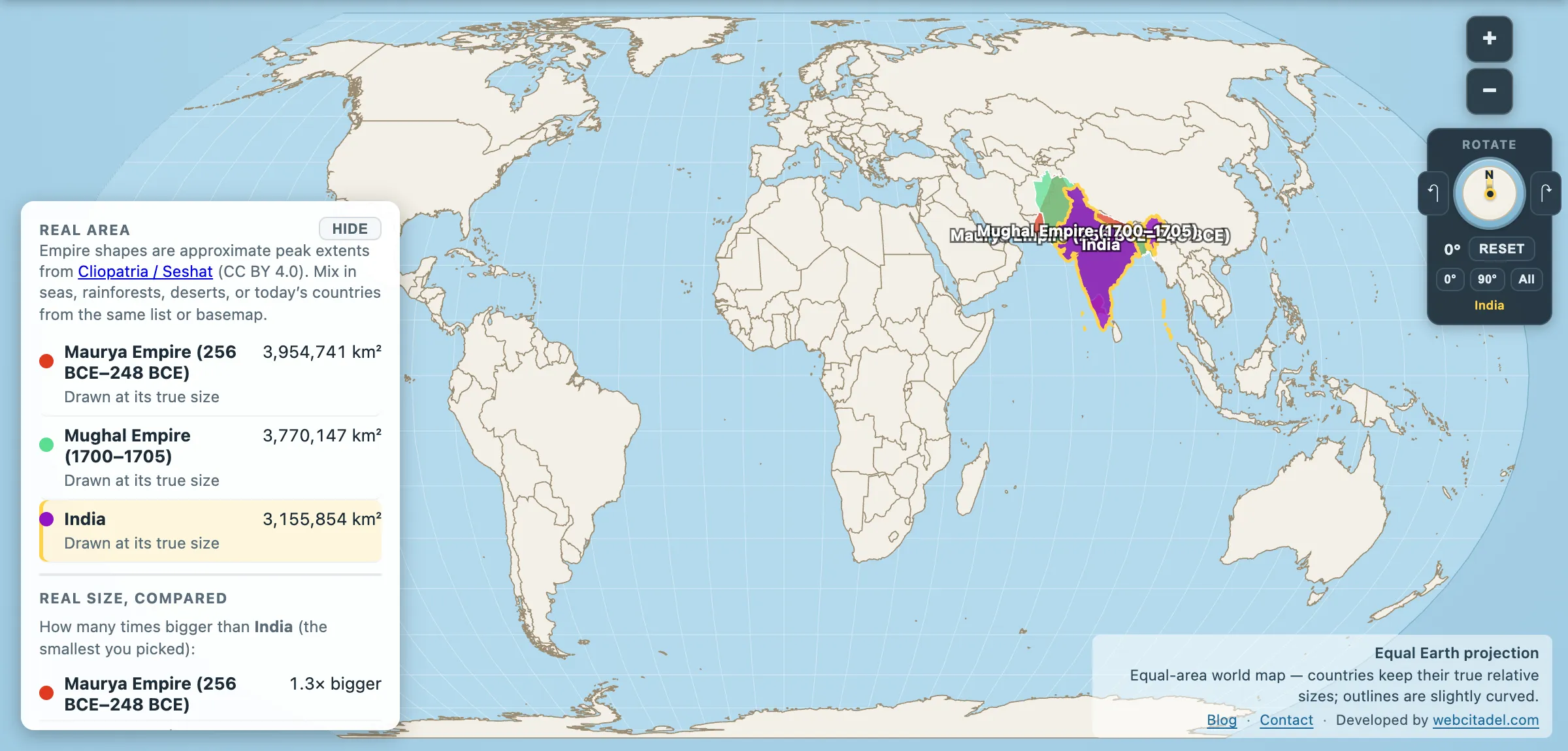
Three states, two thousand years apart, covering much of the same subcontinent. Ranked by area, the order is not the one most people would guess.
- Maurya Empire at its peak, around 250 BC: 3,954,741 km²
- Mughal Empire at its peak, around 1700: 3,770,147 km²
- Modern India: 3,155,854 km²
The oldest is the biggest. The Mauryas, at their maximum under Ashoka, held about 5 per cent more than the Mughals at theirs under Aurangzeb, nearly two millennia later — and about 25 per cent more than the Republic of India holds today.
Ashoka: the empire that changed its mind
The Maurya Empire was founded by Chandragupta Maurya around 322 BC in the vacuum left by Alexander’s withdrawal, and reached its maximum under his grandson Ashoka. At that point it covered nearly the whole subcontinent plus large parts of what is now Afghanistan and Pakistan.
What makes Ashoka unusual is what he did after the last conquest. The Kalinga war — his campaign against the eastern coastal kingdom, conventionally dated to around 260 BC — was won at a cost that his own inscriptions describe in terms of remorse. His edicts, carved on pillars and rock faces across the empire in Prakrit, Greek and Aramaic, set out a policy of dhamma: renunciation of conquest, welfare provision, religious tolerance.
We have the text because he wrote it on rocks, which turns out to be excellent archival practice. Two and a half thousand years later, the lion capital from his pillar at Sarnath is the emblem of the Republic of India, and the wheel from it is on the flag.
Aurangzeb: the peak that broke it
The Mughals reached their greatest extent under Aurangzeb around 1700, after decades of grinding campaigns in the Deccan. On Angus Maddison’s much-used historical estimates, Mughal India at that point accounted for roughly 24 per cent of world GDP and something like a quarter of global manufacturing output. Bengal’s textile industry was one of the great production centres on the planet.
It is also the classic case of a maximum that costs more than it’s worth. The Deccan wars consumed the treasury and the army for a generation, the Marathas were not subdued so much as annoyed, and the religious policies of Aurangzeb’s later reign strained the alliances with Rajput and other non-Muslim elites that earlier emperors — Akbar in particular — had built the state on. Within fifty years of Aurangzeb’s death in 1707 the empire was a name that other people fought over, and the East India Company’s rise begins in the gap.
Why the modern country is the smallest
The third line in that table has an obvious explanation: Partition. What the Maurya and Mughal empires both held as one landmass is now India, Pakistan and Bangladesh, plus — for the Mauryas — much of Afghanistan. Add today’s India, Pakistan (873,784 km²) and Bangladesh (135,676 km²) together and you get 4,165,314 km², comfortably past both empires.
The subcontinent didn’t shrink. It divided, in 1947, along a line drawn in five weeks by a lawyer who had never been to India before.
See all three at once
Open the Maurya, the Mughal and modern India together on an equal-area map. Drag them apart and back. The two empires reach further north and west than the modern country does; the modern country reaches further south than the Mauryas did.
For the same exercise elsewhere, see China under the Qing and Russia under the tsars — both, like the Mauryas, bigger than the state that inherited the name.
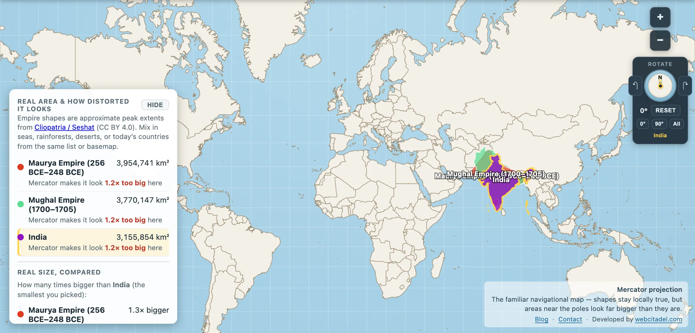
The same shapes on Mercator — the projection almost every map you see uses. Watch what it does to anything far from the equator.
Modern India on its own is on how big India is.
Sources & methodology
- Empire extents: Cliopatria (Seshat Global History Databank), CC BY 4.0, as used in Map Real Size. The Maurya figure is the most contested here: this polygon gives 3.95 million km², while the conventional figures used in Map Real Size’s quiz give 5.0 million. Note the direction — the alternative source makes the Maurya lead over the Mughals larger, not smaller, so the post’s ordering holds either way. Maurya borders in particular are reconstructions from edict find-sites and later textual sources; the southern and western limits are debated, and other reconstructions give notably smaller figures.
- India, Pakistan, Bangladesh: country areas in the app. Several borders in the region are disputed and the numbers move with the source dataset.
- Economic-share figures for the Mughal period are Maddison-style historical estimates with wide error bars.