
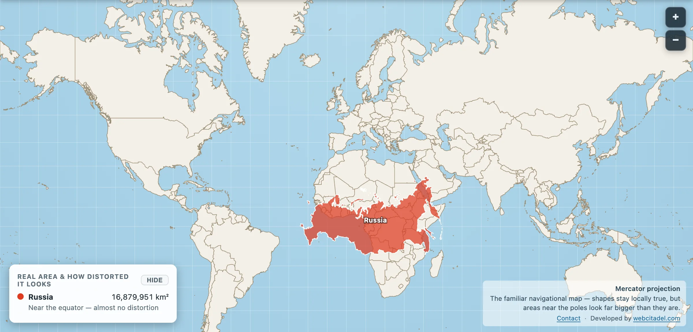
Everything you’ve heard about Russia’s size is true. About 17.1 million km² (the app draws 16,879,951 — see the note at the end), which is 11 per cent of all the land on Earth. Eleven time zones. The Trans-Siberian railway runs 9,289 km from Moscow to Vladivostok and takes a solid week to do it. Runner-up Canada isn’t within seven million square kilometres of it.
Here’s a fun one. For years the internet loved saying Russia is bigger than Pluto. Then in 2015 the New Horizons probe flew past and measured Pluto properly, and it turned out Pluto’s surface is about 17.7 million km². So Pluto edges it. The meme died by 600,000 square kilometres.
The point is, Russia needs no help. And the map helps it anyway.
The inflation racket
Russia’s landmass runs from about 41 degrees north to over 81 at its Arctic islands, and that’s deep inside Mercator’s stretch zone. Across Siberia’s north the map draws land at three, four, even six times its true area. All that Arctic acreage becomes a billboard. What you remember from the classroom isn’t Russia. It’s Russia in platform shoes.
Take the shoes off
Open this scene. Russia is already parked on the equator, draped across Africa, and it looks strange because you’ve never once seen it drawn honestly.
It’s still enormous. It reaches most of the way across the continent. But notice what’s underneath: Africa keeps going. Africa is 30 million km² to Russia’s 17, nearly two Russias of land, and on the wall map it’s the one that looks modest. Same map, both lies, opposite directions.
Drag Russia back north and watch it balloon in real time as the latitude climbs. That growth is pure projection. Not one hectare of actual ground changes.
Then switch to the globe view and let the planet tell it straight. Biggest country on Earth, comfortably. Just not the ceiling of the world the poster promised you.
And if even honest Russia feels big, know this: the Russian Empire was a third bigger again.
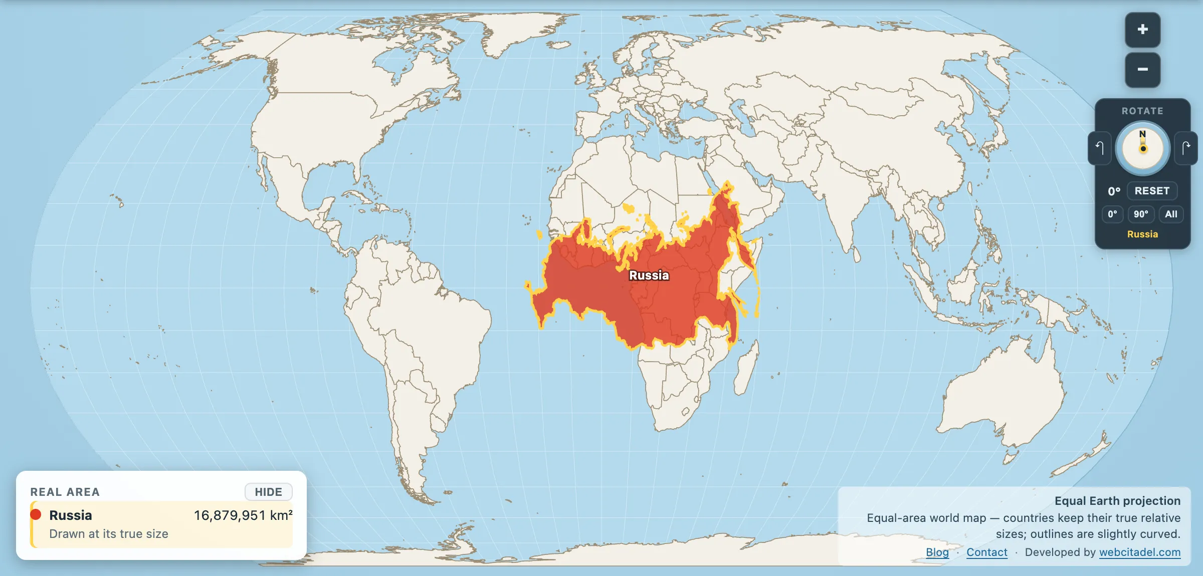
The same shapes on Equal Earth, where every square kilometre is drawn the same size wherever it sits. This is the honest version.
A note on the two Russias
You will see Russia quoted at 17,098,246 km² in most reference works, and at 16,879,951 km² in this app. Both are here on purpose.
The official figure includes inland water — lakes, reservoirs and rivers counted as national territory. The app’s figure is computed from the country’s outline as drawn, at 1:50m generalisation, which trims some of that and smooths the coastline.
The gap is about 1.3 per cent, and it does not touch anything on this page. Every comparison in Map Real Size uses the same method for both shapes, so a like-for-like drag stays honest regardless of which headline number you prefer.